Gateshead night lights from space
Night Light of Gateshead (England) from space (United Kingdom) Src. Average luminocity for 10x10km area is 88.3481% and for 50x50km: 24.4102%.
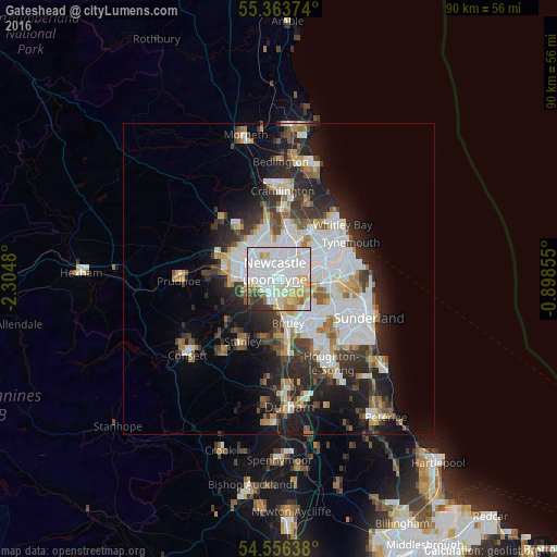
Analysis of Gateshead night lights 2016
Square area 10x10 km:
 40.79%
90-99
26.32%80-89
12.44%70-79
6.22%60-69
3.95%50-59
2.63%40-49
1.32%30-39
4.55%20-29
1.79%10-19
0%0-9
0%Square area 50x50 km:
7.42%90-99
5.28%80-89
2.01%70-79
2.06%60-69
2.31%50-59
2.28%40-49
2.16%30-39
3.9%20-29
6.4%10-19
8.71%0-9
57.45%Clear (daylight) street map image can be seen on geolist.org.
Map coordinates:
55° 21' 49.5" North, 2° 18' 17.3" West
54° 57' 43.5" North, 1° 36' 6" West
54° 33' 23" North, 0° 53' 54.8" West
Some cities around Gateshead sort by population:
• Newcastle upon Tyne
1.5 km =0.9 mi,  327°
327°
• Wallsend
5.4 km =3.4 mi,  53°
53°
• Felling
2.2 km =1.4 mi,  117°
117°
• Gosforth
4.3 km =2.7 mi,  347°
347°
• Hebburn
5.6 km =3.5 mi,  77°
77°
• Whickham
5.1 km =3.2 mi,  248°
248°
• Blaydon-on-Tyne
7.2 km =4.5 mi,  272°
272°
• Benwell
4.5 km =2.8 mi,  285°
285°
2648773 (p: 77,649)
Sources (retrieved 2019-11-25):
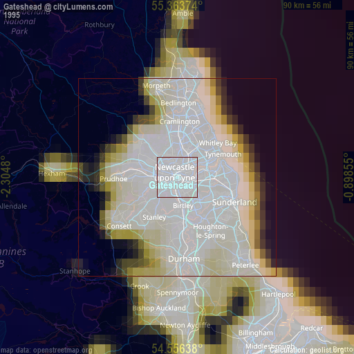
» NASA, Earths city lights 1995
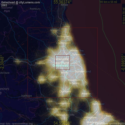
» NASA city lights 2003
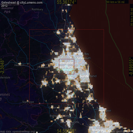
» Earth at Night: Flat Maps 2012, 2016