Esher night lights from space
Night Light of Esher (England) from space (United Kingdom) Src. Average luminocity for 10x10km area is 53.2129% and for 50x50km: 51.6168%.
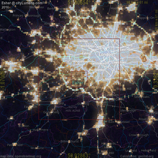
Analysis of Esher night lights 2016
Square area 10x10 km:
 4.76%
4.76%90-99
3.36%80-89
4.06%70-79
4.9%60-69
14.29%50-59
22.27%40-49
17.09%30-39
17.09%20-29
12.18%10-19
0%0-9
0%Square area 50x50 km:
20.45%90-99
10.56%80-89
3.77%70-79
4.02%60-69
4.68%50-59
5.46%40-49
6.11%30-39
5.67%20-29
7.67%10-19
11.78%0-9
19.84%Clear (daylight) street map image can be seen on geolist.org.
Map coordinates:
51° 48' 23.5" North, 1° 4' 12.2" West
51° 22' 10.9" North, 0° 22' 0.9" West
50° 55' 43.1" North, 0° 20' 10.3" East
Some cities around Esher sort by population:
• Sunbury-on-Thames
5.2 km =3.2 mi,  317°
317°
• Walton-on-Thames
3.7 km =2.3 mi,  300°
300°
• Chessington
4.4 km =2.7 mi,  100°
100°
• Hook
4.2 km =2.6 mi,  92°
92°
• West Molesey
3.5 km =2.2 mi,  344°
344°
• East Molesey
3.5 km =2.2 mi,  20°
20°
• Hampton
4.9 km =3 mi,  359°
359°
• Thames Ditton
2.9 km =1.8 mi,  40°
40°
2649911 (p: 52,392)
Sources (retrieved 2019-11-25):
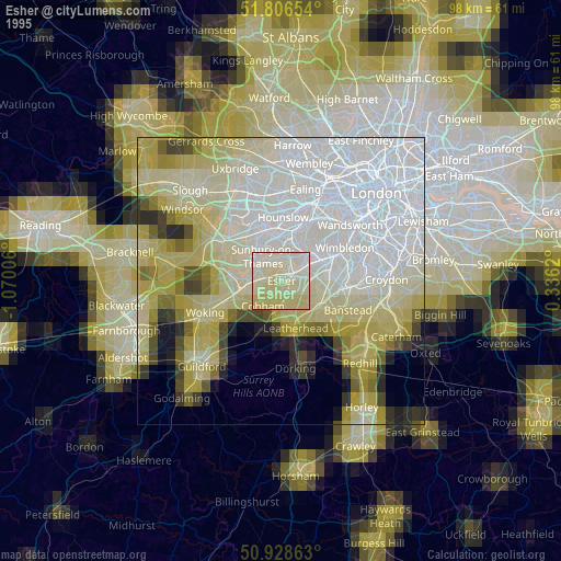
» NASA, Earths city lights 1995
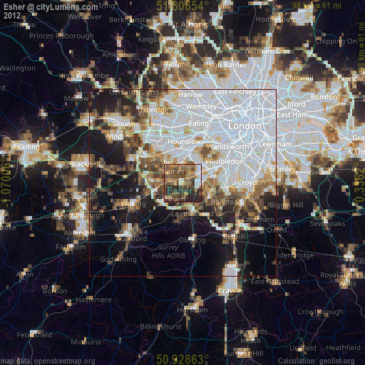
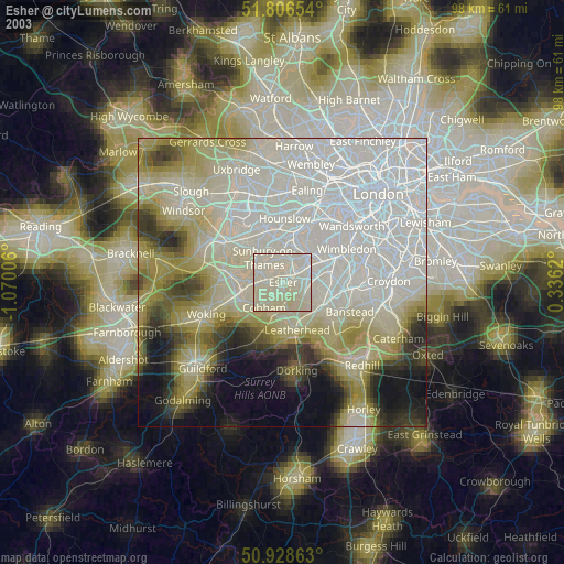
» NASA city lights 2003
» Earth at Night: Flat Maps 2012, 2016