Dunstable night lights from space
Night Light of Dunstable (England) from space (United Kingdom) Src. Average luminocity for 10x10km area is 33.8649% and for 50x50km: 23.0543%.
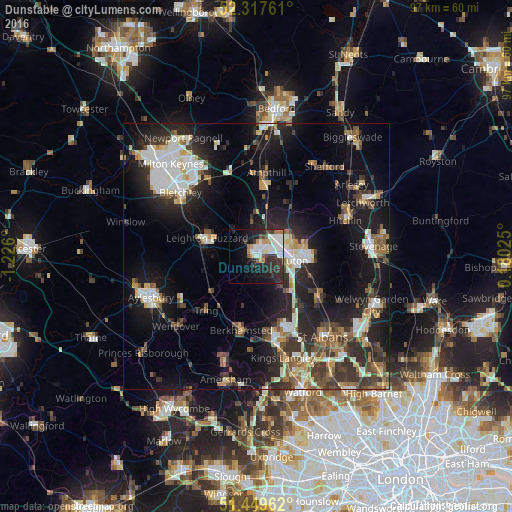
Analysis of Dunstable night lights 2016
Square area 10x10 km:
 9.34%
9.34%90-99
8.08%80-89
1.26%70-79
3.41%60-69
2.65%50-59
2.02%40-49
1.52%30-39
8.96%20-29
11.87%10-19
17.8%0-9
33.08%Square area 50x50 km:
3.79%90-99
4.11%80-89
2.3%70-79
1.93%60-69
2.44%50-59
2.82%40-49
3.28%30-39
4.59%20-29
8%10-19
16.35%0-9
50.39%Clear (daylight) street map image can be seen on geolist.org.
Map coordinates:
52° 19' 3.4" North, 1° 13' 33.6" West
51° 53' 8.6" North, 0° 31' 22.4" West
51° 26' 58.6" North, 0° 10' 48.9" East
Some cities around Dunstable sort by population:
• Luton
7.3 km =4.5 mi,  95°
95°
• Hemel Hempstead
15.5 km =9.6 mi,  161°
161°
• Leighton Buzzard
9.9 km =6.2 mi,  290°
290°
• Harpenden
13.7 km =8.5 mi,  123°
123°
• Berkhamsted
14.2 km =8.8 mi,  191°
191°
• Flitwick
13.2 km =8.2 mi,  8°
8°
• Tring
13.7 km =8.5 mi,  222°
222°
• Redbourn
13 km =8.1 mi,  137°
137°
2650657 (p: 51,973)
Sources (retrieved 2019-11-25):
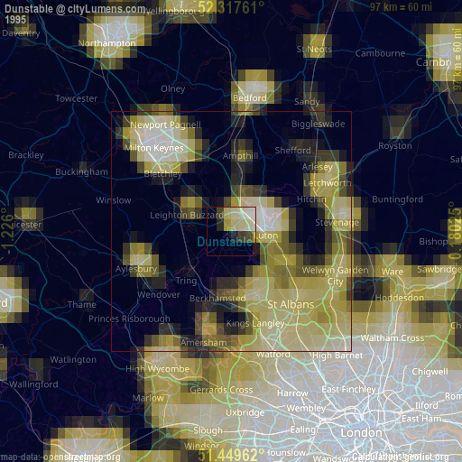
» NASA, Earths city lights 1995
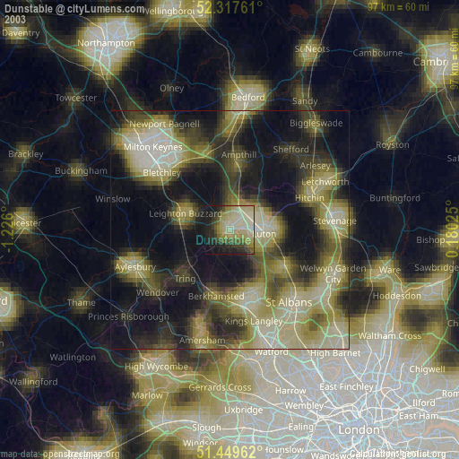
» NASA city lights 2003
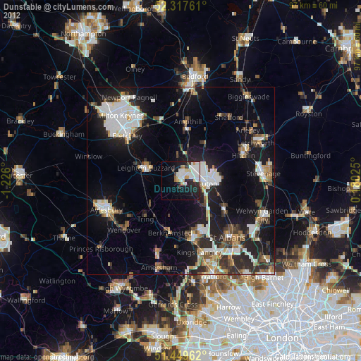
» Earth at Night: Flat Maps 2012, 2016