Cumbernauld night lights from space
Night Light of Cumbernauld (Scotland) from space (United Kingdom) Src. Average luminocity for 10x10km area is 45.5439% and for 50x50km: 30.7836%.
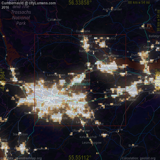
Analysis of Cumbernauld night lights 2016
Square area 10x10 km:
 12.16%
90-99
11.53%80-89
1.75%70-79
2.63%60-69
4.14%50-59
2.13%40-49
4.39%30-39
14.91%20-29
19.42%10-19
21.68%0-9
5.26%Square area 50x50 km:
8.41%90-99
7.78%80-89
2.06%70-79
2.96%60-69
2.9%50-59
2.63%40-49
3.06%30-39
3.83%20-29
7.64%10-19
16.21%0-9
42.52%Clear (daylight) street map image can be seen on geolist.org.
Map coordinates:
56° 20' 18.9" North, 4° 41' 37.1" West
55° 56' 48.7" North, 3° 59' 25.8" West
55° 33' 4" North, 3° 17' 14.6" West
Some cities around Cumbernauld sort by population:
• Coatbridge
9.7 km =6 mi,  192°
192°
• Airdrie
9 km =5.6 mi,  175°
175°
• Kirkintilloch
10.1 km =6.3 mi,  265°
265°
• Kilsyth
5.4 km =3.4 mi,  307°
307°
• Lenzie
10.4 km =6.5 mi,  258°
258°
• Denny
9.9 km =6.2 mi,  31°
31°
• Moodiesburn
6.8 km =4.2 mi,  238°
238°
• Bonnybridge
8.8 km =5.5 mi,  46°
46°
2651715 (p: 51,610)
Sources (retrieved 2019-11-25):
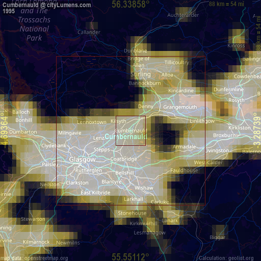
» NASA, Earths city lights 1995
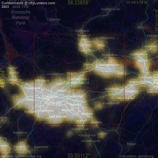
» NASA city lights 2003
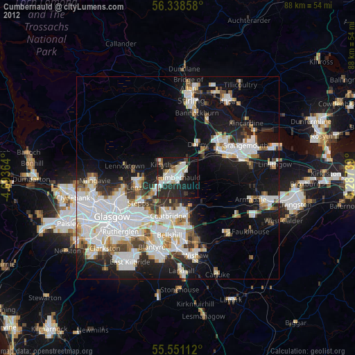
» Earth at Night: Flat Maps 2012, 2016