Coatbridge night lights from space
Night Light of Coatbridge (Scotland) from space (United Kingdom) Src. Average luminocity for 10x10km area is 74.4386% and for 50x50km: 30.1609%.
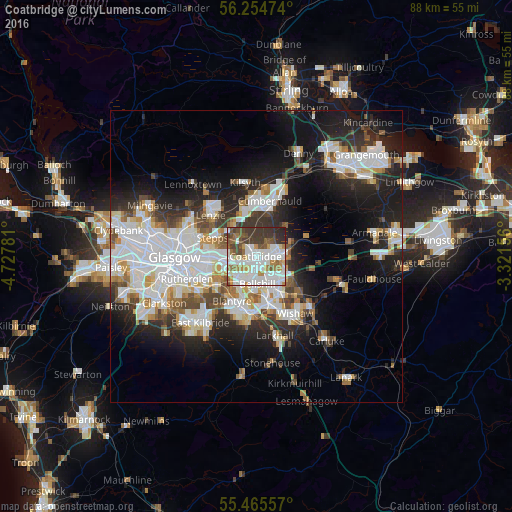
Analysis of Coatbridge night lights 2016
Square area 10x10 km:
 25.19%
90-99
23.68%80-89
3.01%70-79
6.27%60-69
7.89%50-59
8.52%40-49
8.52%30-39
12.41%20-29
4.39%10-19
0.13%0-9
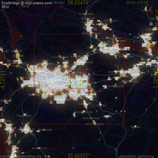
0%Square area 50x50 km:
8.49%90-99
7.68%80-89
1.95%70-79
2.76%60-69
2.85%50-59
2.52%40-49
3.1%30-39
3.83%20-29
7.34%10-19
13.73%0-9
45.76%Clear (daylight) street map image can be seen on geolist.org.
Map coordinates:
56° 15' 17.1" North, 4° 43' 40.1" West
55° 51' 43.8" North, 4° 1' 28.9" West
55° 27' 56.1" North, 3° 19' 17.6" West
Some cities around Coatbridge sort by population:
• Airdrie
2.8 km =1.7 mi,  81°
81°
• Bellshill
5.1 km =3.2 mi,  174°
174°
• Viewpark
4.4 km =2.7 mi,  207°
207°
• Moodiesburn
6.9 km =4.3 mi,  328°
328°
• Chapelhall
5.2 km =3.2 mi,  113°
113°
• Uddingston
6 km =3.7 mi,  217°
217°
• New Stevenston
6 km =3.7 mi,  147°
147°
• Holytown
5.7 km =3.5 mi, 145°
2652696 (p: 43,970)
Sources (retrieved 2019-11-25):
» Earth at Night: Flat Maps 2012, 2016