Chapelhall night lights from space
Night Light of Chapelhall (Scotland) from space (United Kingdom) Src. Average luminocity for 10x10km area is 57.4837% and for 50x50km: 28.4996%.
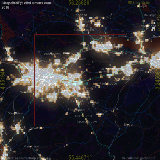
Analysis of Chapelhall night lights 2016
Square area 10x10 km:
 18.17%
90-99
16.79%80-89
2.01%70-79
6.39%60-69
5.26%50-59
8.65%40-49
4.64%30-39
4.39%20-29
9.52%10-19
14.29%0-9
9.9%Square area 50x50 km:
7.69%90-99
7.09%80-89
1.9%70-79
2.64%60-69
2.72%50-59
2.46%40-49
2.93%30-39
3.75%20-29
7.72%10-19
13.45%0-9
47.65%Clear (daylight) street map image can be seen on geolist.org.
Map coordinates:
56° 14' 10.5" North, 4° 39' 7" West
55° 50' 36.6" North, 3° 56' 55.7" West
55° 26' 48.2" North, 3° 14' 44.5" West
Some cities around Chapelhall sort by population:
• Coatbridge
5.2 km =3.2 mi,  293°
293°
• Airdrie
3.2 km =2 mi,  321°
321°
• Motherwell
6.6 km =4.1 mi,  204°
204°
• Bellshill
5.2 km =3.2 mi,  234°
234°
• Viewpark
7 km =4.3 mi,  255°
255°
• Newarthill
3.2 km =2 mi,  167°
167°
• New Stevenston
3.4 km =2.1 mi,  207°
207°
• Holytown
3 km =1.9 mi, 209°
2653366 (p: 6,560)
Sources (retrieved 2019-11-25):
» Earth at Night: Flat Maps 2012, 2016