Bridgend night lights from space
Night Light of Bridgend (Wales) from space (United Kingdom) Src. Average luminocity for 10x10km area is 31.266% and for 50x50km: 12.6906%.
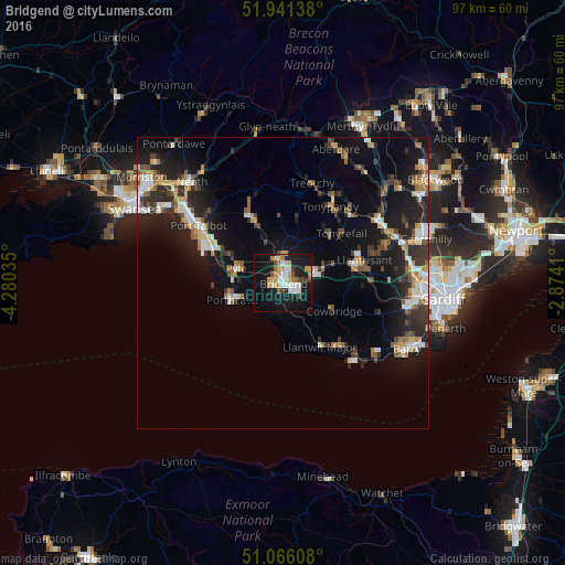
Analysis of Bridgend night lights 2016
Square area 10x10 km:
 5.48%
5.48%90-99
5.08%80-89
4.55%70-79
5.75%60-69
3.74%50-59
0.27%40-49
3.74%30-39
1.34%20-29
4.55%10-19
39.57%0-9
25.94%Square area 50x50 km:
1.48%90-99
2.08%80-89
1.07%70-79
1.44%60-69
1.65%50-59
1.43%40-49
1.58%30-39
2.26%20-29
4.27%10-19
11.65%0-9
71.09%Clear (daylight) street map image can be seen on geolist.org.
Map coordinates:
51° 56' 29" North, 4° 16' 49.3" West
51° 30' 21" North, 3° 34' 38" West
51° 3' 57.9" North, 2° 52' 26.8" West
Some cities around Bridgend sort by population:
• Coity
2.4 km =1.5 mi,  40°
40°
• Porthcawl
9.2 km =5.7 mi,  251°
251°
• Llantwit Major
12.3 km =7.6 mi,  149°
149°
• Pyle
8.6 km =5.3 mi,  278°
278°
• Aberkenfig
4 km =2.5 mi,  341°
341°
• Pencoed
5.7 km =3.5 mi,  69°
69°
• Brynna
8.6 km =5.3 mi, 65°
• Llanharan
10.2 km =6.3 mi, 69°
2654755 (p: 58,380)
Sources (retrieved 2019-11-25):
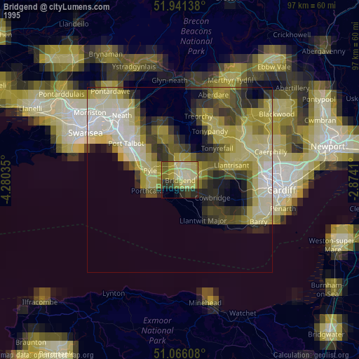
» NASA, Earths city lights 1995
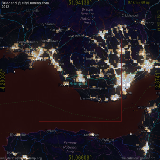
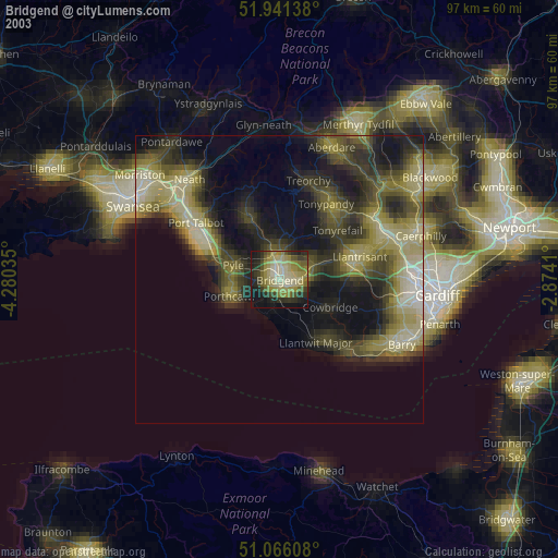
» NASA city lights 2003
» Earth at Night: Flat Maps 2012, 2016