Bramhall night lights from space
Night Light of Bramhall (England) from space (United Kingdom) Src. Average luminocity for 10x10km area is 60.4735% and for 50x50km: 32.1235%.
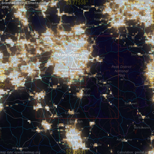
Analysis of Bramhall night lights 2016
Square area 10x10 km:
 13.89%
90-99
14.02%80-89
7.28%70-79
10.58%60-69
7.28%50-59
7.8%40-49
5.95%30-39
5.95%20-29
13.89%10-19
12.57%0-9
0.79%Square area 50x50 km:
9.79%90-99
7.44%80-89
3.29%70-79
3.31%60-69
3.39%50-59
3.07%40-49
3.28%30-39
3.39%20-29
5.25%10-19
9.65%0-9
48.15%Clear (daylight) street map image can be seen on geolist.org.
Map coordinates:
53° 46' 32.1" North, 2° 52' 6.7" West
53° 21' 28.8" North, 2° 9' 55.4" West
52° 56' 10.7" North, 1° 27' 44.2" West
Some cities around Bramhall sort by population:
• Stockport
5.8 km =3.6 mi,  5°
5°
• Wilmslow
5.5 km =3.4 mi,  232°
232°
• Cheadle Hulme
2.6 km =1.6 mi,  321°
321°
• Marple
7.9 km =4.9 mi,  59°
59°
• Hazel Grove
4.3 km =2.7 mi,  48°
48°
• Bredbury
7.3 km =4.5 mi,  26°
26°
• Poynton
3.4 km =2.1 mi,  105°
105°
• Didsbury
7.9 km =4.9 mi,  326°
326°
2654927 (p: 25,506)
Sources (retrieved 2019-11-25):
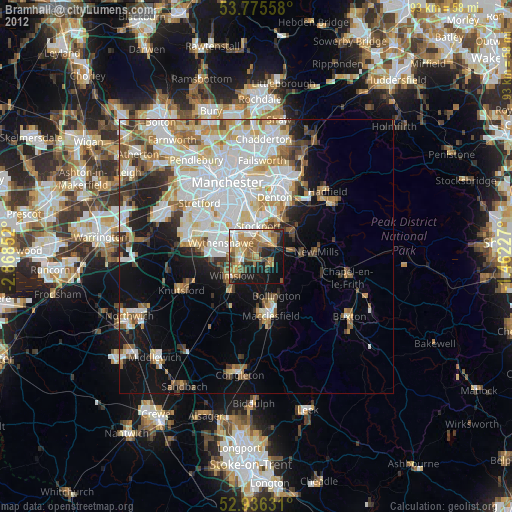
» Earth at Night: Flat Maps 2012, 2016