Wittelsheim night lights from space
Night Light of Wittelsheim (Grand Est) from space (France) Src. Average luminocity for 10x10km area is 41.1176% and for 50x50km: 17.0094%.
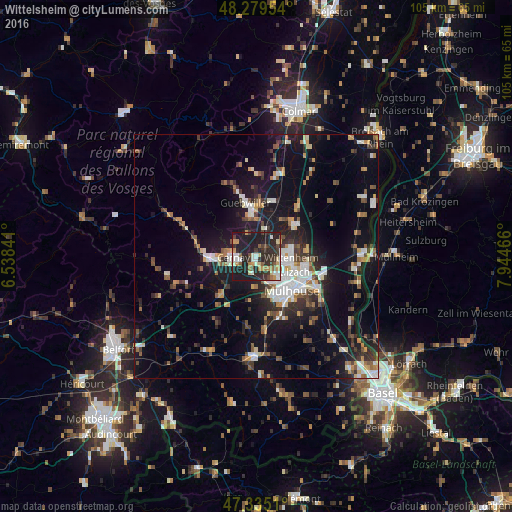
Analysis of Wittelsheim night lights 2016
Square area 10x10 km:
 4.91%
4.91%90-99
6.7%80-89
4.46%70-79
7.14%60-69
3.27%50-59
3.87%40-49
4.76%30-39
10.12%20-29
24.26%10-19
30.51%0-9
0%Square area 50x50 km:
2.65%90-99
2.64%80-89
1.26%70-79
1.9%60-69
1.67%50-59
2.12%40-49
2.33%30-39
2.78%20-29
4.69%10-19
15.28%0-9
62.69%Clear (daylight) street map image can be seen on geolist.org.
Map coordinates:
48° 16' 46.3" North, 6° 32' 18.3" East
47° 48' 34.1" North, 7° 14' 29.5" East
47° 20' 6.4" North, 7° 56' 40.8" East
Some cities around Wittelsheim sort by population:
• Mulhouse
9.1 km =5.7 mi,  134°
134°
• Illzach
9.1 km =5.7 mi,  115°
115°
• Kingersheim
6.7 km =4.2 mi,  107°
107°
• Cernay
4.8 km =3 mi,  270°
270°
• Pfastatt
6.4 km =4 mi, 134°
• Soultz-Haut-Rhin
8.8 km =5.5 mi,  353°
353°
• Lutterbach
6.2 km =3.9 mi,  152°
152°
• Sausheim
10.1 km =6.3 mi,  104°
104°
2967319 (p: 10,220)
Sources (retrieved 2019-11-25):
» Earth at Night: Flat Maps 2012, 2016