Kingersheim night lights from space
Night Light of Kingersheim (Grand Est) from space (France) Src. Average luminocity for 10x10km area is 71.3646% and for 50x50km: 18.4964%.
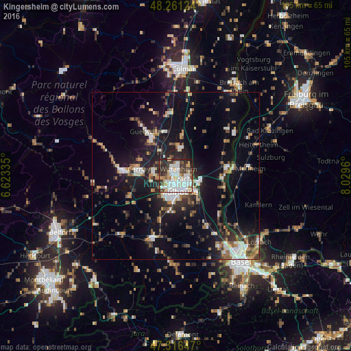
Analysis of Kingersheim night lights 2016
Square area 10x10 km:
 28.13%
90-99
18.45%80-89
5.95%70-79
5.21%60-69
5.65%50-59
2.98%40-49
6.25%30-39
14.14%20-29
12.05%10-19
1.19%0-9
0%Square area 50x50 km:
3.08%90-99
2.97%80-89
1.23%70-79
2.06%60-69
1.83%50-59
2.44%40-49
2.5%30-39
3.04%20-29
4.99%10-19
15.17%0-9
60.68%Clear (daylight) street map image can be seen on geolist.org.
Map coordinates:
48° 15' 40.5" North, 6° 37' 24.1" East
47° 47' 27.6" North, 7° 19' 35.3" East
47° 18' 59.3" North, 8° 1' 46.6" East
Some cities around Kingersheim sort by population:
• Mulhouse
4.3 km =2.7 mi,  177°
177°
• Wittenheim
2.2 km =1.4 mi,  2°
2°
• Illzach
2.7 km =1.7 mi,  134°
134°
• Riedisheim
5.6 km =3.5 mi,  147°
147°
• Wittelsheim
6.7 km =4.2 mi,  287°
287°
• Pfastatt
3 km =1.9 mi,  215°
215°
• Lutterbach
4.9 km =3 mi, 224°
• Sausheim
3.5 km =2.2 mi,  97°
97°
3011456 (p: 12,690)
Sources (retrieved 2019-11-25):
» Earth at Night: Flat Maps 2012, 2016