Mulhouse night lights from space
Night Light of Mulhouse (Grand Est) from space (France) Src. Average luminocity for 10x10km area is 73.942% and for 50x50km: 20.3016%.
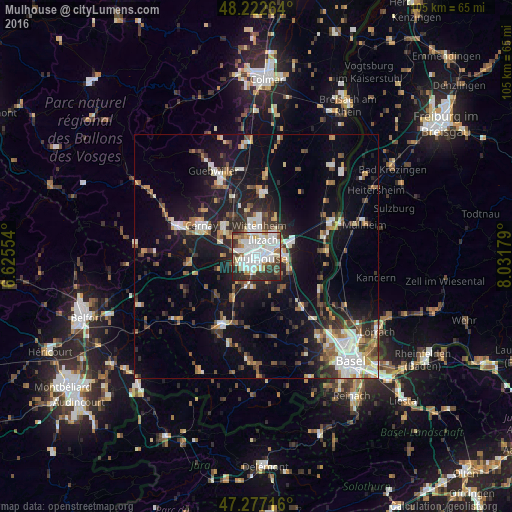
Analysis of Mulhouse night lights 2016
Square area 10x10 km:
 33.18%
90-99
17.26%80-89
5.65%70-79
4.02%60-69
7.14%50-59
4.02%40-49
5.65%30-39
10.27%20-29
12.35%10-19
0.45%0-9
0%Square area 50x50 km:
3.73%90-99
3.52%80-89
1.38%70-79
2.21%60-69
1.96%50-59
2.75%40-49
2.69%30-39
3.17%20-29
5.22%10-19
15.07%0-9
58.31%Clear (daylight) street map image can be seen on geolist.org.
Map coordinates:
48° 13' 21.5" North, 6° 37' 31.9" East
47° 45' 7.4" North, 7° 19' 43.2" East
47° 16' 37.8" North, 8° 1' 54.4" East
Some cities around Mulhouse sort by population:
• Illzach
3 km =1.9 mi,  35°
35°
• Rixheim
5.5 km =3.4 mi,  92°
92°
• Riedisheim
2.9 km =1.8 mi,  97°
97°
• Kingersheim
4.3 km =2.7 mi,  357°
357°
• Pfastatt
2.7 km =1.7 mi,  314°
314°
• Lutterbach
3.7 km =2.3 mi,  283°
283°
• Brunstatt
3.5 km =2.2 mi,  190°
190°
• Sausheim
5.1 km =3.2 mi, 40°
2991214 (p: 111,430)
Sources (retrieved 2019-11-25):
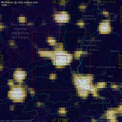
» NASA, Earths city lights 1995
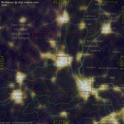
» NASA city lights 2003
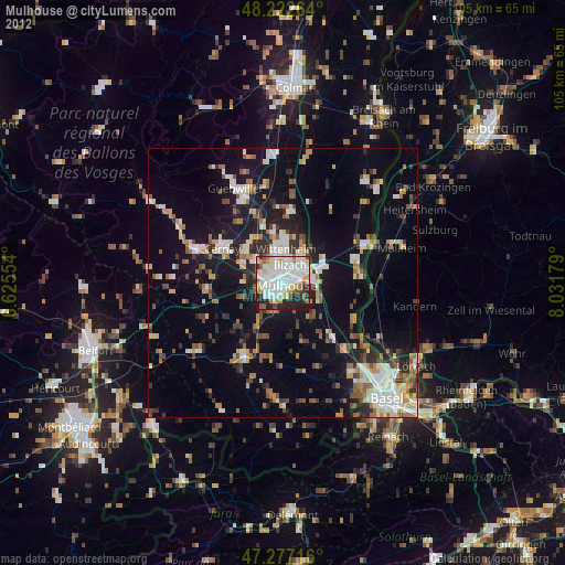
» Earth at Night: Flat Maps 2012, 2016