Vannes night lights from space
Night Light of Vannes (Brittany) from space (France) Src. Average luminocity for 10x10km area is 40.7708% and for 50x50km: 3.5096%.
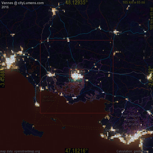
Analysis of Vannes night lights 2016
Square area 10x10 km:
 9.97%
9.97%90-99
11.76%80-89
2.68%70-79
3.57%60-69
3.42%50-59
2.68%40-49
2.23%30-39
2.68%20-29
11.46%10-19
38.54%0-9
11.01%Square area 50x50 km:
0.5%90-99
0.75%80-89
0.26%70-79
0.39%60-69
0.22%50-59
0.33%40-49
0.54%30-39
0.6%20-29
0.68%10-19
2.16%0-9
93.56%Clear (daylight) street map image can be seen on geolist.org.
Map coordinates:
48° 7' 45.7" North, 3° 27' 31.9" West
47° 39' 28.4" North, 2° 45' 20.7" West
47° 10' 55.8" North, 2° 3' 9.4" West
Some cities around Vannes sort by population:
• Auray
17.7 km =11 mi,  274°
274°
• Saint-Avé
3.7 km =2.3 mi,  10°
10°
• Séné
4.5 km =2.8 mi,  162°
162°
• Sarzeau
14.5 km =9 mi,  184°
184°
• Questembert
22.7 km =14.1 mi,  88°
88°
• Theix
8.4 km =5.2 mi,  112°
112°
• Arradon
6 km =3.7 mi,  235°
235°
• Brech
19.5 km =12.1 mi,  291°
291°
2970777 (p: 54,020)
Sources (retrieved 2019-11-25):
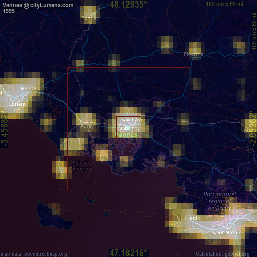
» NASA, Earths city lights 1995
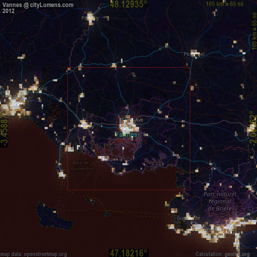
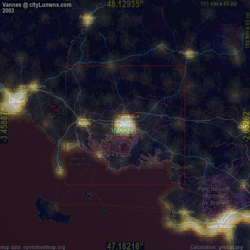
» NASA city lights 2003
» Earth at Night: Flat Maps 2012, 2016