Tomblaine night lights from space
Night Light of Tomblaine (Grand Est) from space (France) Src. Average luminocity for 10x10km area is 74.6339% and for 50x50km: 12.3741%.
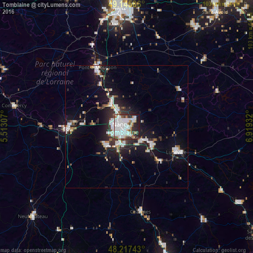
Analysis of Tomblaine night lights 2016
Square area 10x10 km:
 35.12%
90-99
22.17%80-89
3.57%70-79
3.42%60-69
3.87%50-59
4.76%40-49
3.27%30-39
6.99%20-29
10.71%10-19
5.95%0-9
0.15%Square area 50x50 km:
2.98%90-99
2.86%80-89
0.66%70-79
0.77%60-69
0.88%50-59
1.06%40-49
1.05%30-39
1.9%20-29
3.45%10-19
9.8%0-9
74.6%Clear (daylight) street map image can be seen on geolist.org.
Map coordinates:
49° 8' 45.1" North, 5° 30' 47.1" East
48° 41' 1.6" North, 6° 12' 58.3" East
48° 13' 2.7" North, 6° 55' 9.6" East
Some cities around Tomblaine sort by population:
• Nancy
2.3 km =1.4 mi,  271°
271°
• Vandœuvre-lès-Nancy
4.5 km =2.8 mi,  212°
212°
• Saint-Max
2.4 km =1.5 mi,  343°
343°
• Jarville-la-Malgrange
2.1 km =1.3 mi, 207°
• Malzéville
3.9 km =2.4 mi,  323°
323°
• Essey-lès-Nancy
2.5 km =1.6 mi,  18°
18°
• Heillecourt
4 km =2.5 mi,  202°
202°
• Laneuveville-devant-Nancy
3.1 km =1.9 mi,  165°
165°
2972486 (p: 7,703)
Sources (retrieved 2019-11-25):
» Earth at Night: Flat Maps 2012, 2016