Nancy night lights from space
Night Light of Nancy (Grand Est) from space (France) Src. Average luminocity for 10x10km area is 82.6949% and for 50x50km: 12.494%.
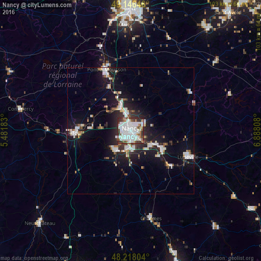
Analysis of Nancy night lights 2016
Square area 10x10 km:
 39.73%
90-99
27.83%80-89
1.79%70-79
3.42%60-69
4.02%50-59
5.8%40-49
4.02%30-39
10.42%20-29
2.98%10-19
0%0-9
0%Square area 50x50 km:
2.99%90-99
2.91%80-89
0.68%70-79
0.78%60-69
0.88%50-59
1.05%40-49
1.07%30-39
1.89%20-29
3.45%10-19
10.14%0-9
74.15%Clear (daylight) street map image can be seen on geolist.org.
Map coordinates:
49° 8' 47.3" North, 5° 28' 54.6" East
48° 41' 3.8" North, 6° 11' 5.9" East
48° 13' 4.9" North, 6° 53' 17.1" East
Some cities around Nancy sort by population:
• Laxou
2.6 km =1.6 mi,  268°
268°
• Villers-lès-Nancy
2.7 km =1.7 mi,  242°
242°
• Saint-Max
2.7 km =1.7 mi,  36°
36°
• Jarville-la-Malgrange
2.3 km =1.4 mi,  146°
146°
• Maxéville
3.5 km =2.2 mi,  337°
337°
• Malzéville
3.1 km =1.9 mi,  359°
359°
• Essey-lès-Nancy
3.8 km =2.4 mi,  53°
53°
• Tomblaine
2.3 km =1.4 mi,  91°
91°
2990999 (p: 105,334)
Sources (retrieved 2019-11-25):
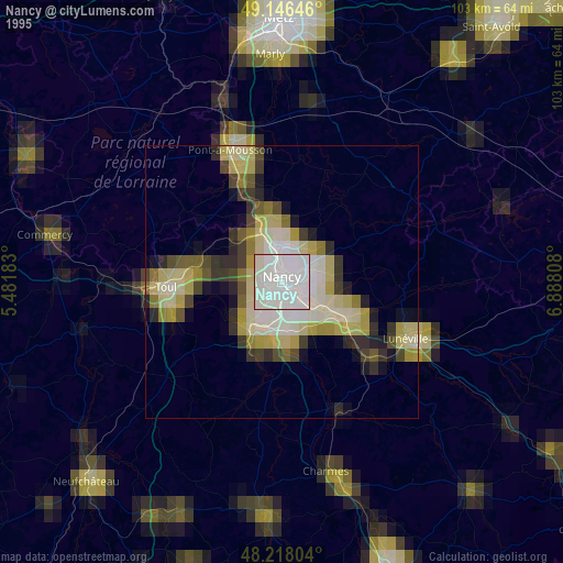
» NASA, Earths city lights 1995
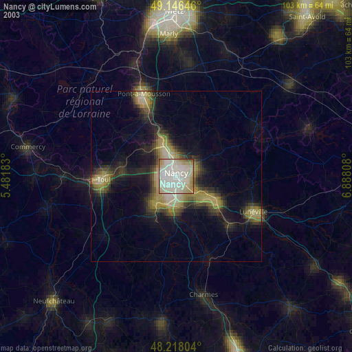
» NASA city lights 2003
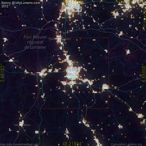
» Earth at Night: Flat Maps 2012, 2016