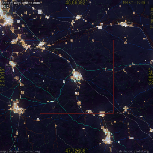
Sens night lights from space
Night Light of Sens (Bourgogne-Franche-Comté) from space (France) Src. Average luminocity for 10x10km area is 35.8943% and for 50x50km: 3.6132%.

Analysis of Sens night lights 2016
Square area 10x10 km:
 9.82%
9.82%90-99
5.95%80-89
3.42%70-79
3.27%60-69
4.61%50-59
4.32%40-49
2.08%30-39
1.04%20-29
6.85%10-19
36.9%0-9
21.73%Square area 50x50 km:
0.62%90-99
0.49%80-89
0.38%70-79
0.51%60-69
0.38%50-59
0.56%40-49
0.39%30-39
0.25%20-29
0.43%10-19
2.77%0-9
93.21%Clear (daylight) street map image can be seen on geolist.org.
Map coordinates:
48° 39' 50.1" North, 2° 34' 48.5" East
48° 11' 50.6" North, 3° 16' 59.8" East
47° 43' 35.6" North, 3° 59' 11" East
Some cities around Sens sort by population:
• Montereau-Fault-Yonne
32.2 km =20 mi,  309°
309°
• Provins
40.2 km =25 mi,  1°
1°
• Joigny
25.4 km =15.8 mi,  159°
159°
• Migennes
31.1 km =19.3 mi,  145°
145°
• Nogent-sur-Seine
36.7 km =22.8 mi,  26°
26°
• Souppes-sur-Loing
40.7 km =25.3 mi,  267°
267°
• Saint-Florentin
39.4 km =24.5 mi,  123°
123°
• Villeneuve-sur-Yonne
12.8 km =8 mi,  175°
175°
2975050 (p: 28,700)
Sources (retrieved 2019-11-25):
» Earth at Night: Flat Maps 2012, 2016