Provins night lights from space
Night Light of Provins (Île-de-France) from space (France) Src. Average luminocity for 10x10km area is 14.4494% and for 50x50km: 2.6819%.
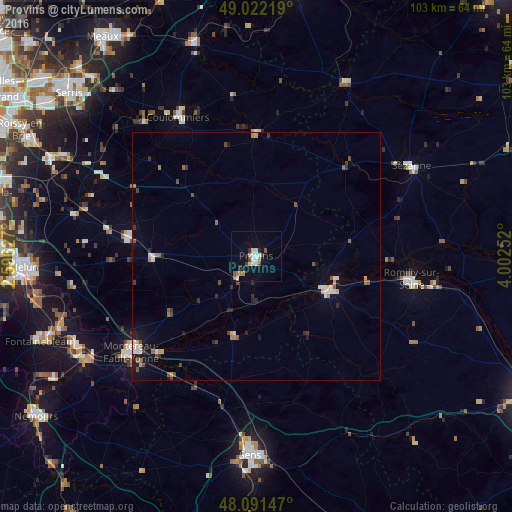
Analysis of Provins night lights 2016
Square area 10x10 km:
 2.98%
2.98%90-99
2.38%80-89
1.19%70-79
1.34%60-69
2.08%50-59
1.34%40-49
1.79%30-39
1.34%20-29
1.04%10-19
4.17%0-9
80.36%Square area 50x50 km:
0.37%90-99
0.4%80-89
0.11%70-79
0.27%60-69
0.36%50-59
0.43%40-49
0.43%30-39
0.38%20-29
0.37%10-19
1.15%0-9
95.73%Clear (daylight) street map image can be seen on geolist.org.
Map coordinates:
49° 1' 19.9" North, 2° 35' 46.6" East
48° 33' 32.3" North, 3° 17' 57.8" East
48° 5' 29.3" North, 4° 0' 9.1" East
Some cities around Provins sort by population:
• Sens
40.2 km =25 mi,  181°
181°
• Montereau-Fault-Yonne
32.3 km =20.1 mi,  232°
232°
• Coulommiers
32.5 km =20.2 mi,  331°
331°
• Romilly-sur-Seine
31.9 km =19.8 mi,  99°
99°
• Nangis
21.1 km =13.1 mi,  268°
268°
• Nogent-sur-Seine
16.6 km =10.3 mi,  115°
115°
• Sézanne
36 km =22.4 mi,  60°
60°
• Fontenay-Trésigny
35.5 km =22.1 mi,  297°
297°
2985229 (p: 12,685)
Sources (retrieved 2019-11-25):
» Earth at Night: Flat Maps 2012, 2016