Saint-Jean-de-la-Ruelle night lights from space
Night Light of Saint-Jean-de-la-Ruelle (Centre) from space (France) Src. Average luminocity for 10x10km area is 78.875% and for 50x50km: 9.335%.
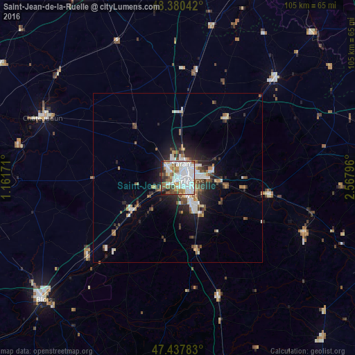
Analysis of Saint-Jean-de-la-Ruelle night lights 2016
Square area 10x10 km:
 28.13%
90-99
28.69%80-89
2.7%70-79
6.96%60-69
9.38%50-59
7.1%40-49
4.97%30-39
3.84%20-29
5.68%10-19
2.56%0-9
0%Square area 50x50 km:
1.89%90-99
2.17%80-89
0.52%70-79
0.86%60-69
0.99%50-59
1.31%40-49
1.1%30-39
1.19%20-29
2.39%10-19
4.34%0-9
83.24%Clear (daylight) street map image can be seen on geolist.org.
Map coordinates:
48° 22' 49.5" North, 1° 9' 42.2" East
47° 54' 40.6" North, 1° 51' 53.4" East
47° 26' 16.2" North, 2° 34' 4.7" East
Some cities around Saint-Jean-de-la-Ruelle sort by population:
• Orléans
3.1 km =1.9 mi,  107°
107°
• Olivet
6 km =3.7 mi,  154°
154°
• Fleury-les-Aubrais
4.7 km =2.9 mi,  58°
58°
• Saran
4.4 km =2.7 mi,  10°
10°
• La Chapelle-Saint-Mesmin
3.6 km =2.2 mi,  219°
219°
• Ingré
2.9 km =1.8 mi,  289°
289°
• Chécy
11.9 km =7.4 mi,  99°
99°
• Meung-sur-Loire
15.4 km =9.6 mi,  234°
234°
2979316 (p: 17,522)
Sources (retrieved 2019-11-25):
» Earth at Night: Flat Maps 2012, 2016