Saint-Germain-du-Puy night lights from space
Night Light of Saint-Germain-du-Puy (Centre) from space (France) Src. Average luminocity for 10x10km area is 27.7003% and for 50x50km: 6.0364%.
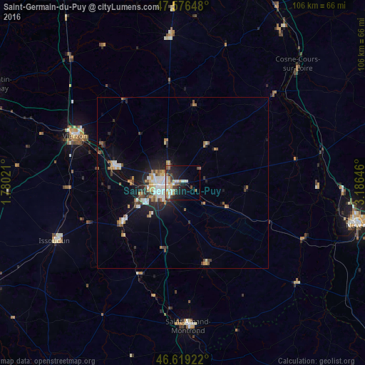
Analysis of Saint-Germain-du-Puy night lights 2016
Square area 10x10 km:
 4.4%
4.4%90-99
7.81%80-89
1.7%70-79
4.97%60-69
1.7%50-59
1.42%40-49
5.26%30-39
1.85%20-29
8.95%10-19
16.76%0-9
45.17%Square area 50x50 km:
0.92%90-99
1.15%80-89
0.55%70-79
0.87%60-69
0.55%50-59
0.61%40-49
0.84%30-39
0.6%20-29
1.77%10-19
3.91%0-9
88.23%Clear (daylight) street map image can be seen on geolist.org.
Map coordinates:
47° 34' 35.3" North, 1° 46' 48.8" East
47° 6' 0" North, 2° 28' 60" East
46° 37' 9.2" North, 3° 11' 11.3" East
Some cities around Saint-Germain-du-Puy sort by population:
• Bourges
6.6 km =4.1 mi,  253°
253°
• Vierzon
34.2 km =21.3 mi,  293°
293°
• Issoudun
40.8 km =25.4 mi, 245°
• Cosne-Cours-sur-Loire
48 km =29.8 mi,  43°
43°
• Mehun-sur-Yèvre
21 km =13 mi,  281°
281°
• Aubigny-sur-Nère
43.3 km =26.9 mi,  355°
355°
• Salbris
48.6 km =30.2 mi,  317°
317°
• La Charité-sur-Loire
41.4 km =25.7 mi,  77°
77°
2979790 (p: 5,057)
Sources (retrieved 2019-11-25):
» Earth at Night: Flat Maps 2012, 2016