Saint-Benoît night lights from space
Night Light of Saint-Benoît (Nouvelle-Aquitaine) from space (France) Src. Average luminocity for 10x10km area is 42.5085% and for 50x50km: 4.7396%.
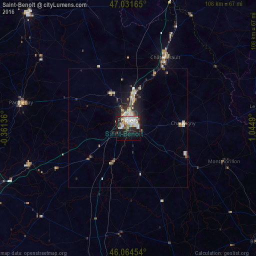
Analysis of Saint-Benoît night lights 2016
Square area 10x10 km:
 11.51%
90-99
12.22%80-89
5.11%70-79
0.99%60-69
3.84%50-59
2.13%40-49
4.55%30-39
1.99%20-29
13.49%10-19
25.85%0-9
18.32%Square area 50x50 km:
0.72%90-99
0.96%80-89
0.55%70-79
0.38%60-69
0.51%50-59
0.55%40-49
0.54%30-39
0.48%20-29
1.58%10-19
3.35%0-9
90.4%Clear (daylight) street map image can be seen on geolist.org.
Map coordinates:
47° 1' 53.9" North, 0° 21' 40.9" West
46° 33' 0.9" North, 0° 20' 30.4" East
46° 3' 52.3" North, 1° 2' 41.6" East
Some cities around Saint-Benoît sort by population:
• Poitiers
3.6 km =2.2 mi,  2°
2°
• Châtellerault
33.5 km =20.8 mi,  27°
27°
• Buxerolles
13.1 km =8.1 mi,  55°
55°
• Montmorillon
42.7 km =26.5 mi,  108°
108°
• Chauvigny
23.2 km =14.4 mi,  84°
84°
• Migné
8.8 km =5.5 mi,  346°
346°
• Jaunay-Clan
15.2 km =9.4 mi,  8°
8°
• Naintré
26 km =16.2 mi,  24°
24°
2981408 (p: 7,598)
Sources (retrieved 2019-11-25):
» Earth at Night: Flat Maps 2012, 2016