Migné night lights from space
Night Light of Migné (Nouvelle-Aquitaine) from space (France) Src. Average luminocity for 10x10km area is 36.9148% and for 50x50km: 5.1926%.
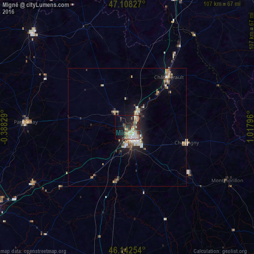
Analysis of Migné night lights 2016
Square area 10x10 km:
 7.1%
7.1%90-99
7.53%80-89
4.26%70-79
4.97%60-69
3.27%50-59
4.4%40-49
4.83%30-39
3.13%20-29
15.2%10-19
18.61%0-9
26.7%Square area 50x50 km:
0.71%90-99
0.95%80-89
0.64%70-79
0.45%60-69
0.62%50-59
0.69%40-49
0.59%30-39
0.53%20-29
1.64%10-19
3.86%0-9
89.32%Clear (daylight) street map image can be seen on geolist.org.
Map coordinates:
47° 6' 29.8" North, 0° 23' 17.8" West
46° 37' 39.2" North, 0° 18' 53.4" East
46° 8' 33.1" North, 1° 1' 4.7" East
Some cities around Migné sort by population:
• Poitiers
5.5 km =3.4 mi,  156°
156°
• Châtellerault
27.4 km =17 mi,  39°
39°
• Parthenay
42.9 km =26.7 mi,  273°
273°
• Buxerolles
12.9 km =8 mi,  95°
95°
• Saint-Benoît
8.8 km =5.5 mi,  166°
166°
• Chauvigny
25.9 km =16.1 mi, 104°
• Jaunay-Clan
7.7 km =4.8 mi,  34°
34°
• Naintré
19.8 km =12.3 mi, 40°
2993918 (p: 6,164)
Sources (retrieved 2019-11-25):
» Earth at Night: Flat Maps 2012, 2016