Chauvigny night lights from space
Night Light of Chauvigny (Nouvelle-Aquitaine) from space (France) Src. Average luminocity for 10x10km area is 6.483% and for 50x50km: 3.8387%.
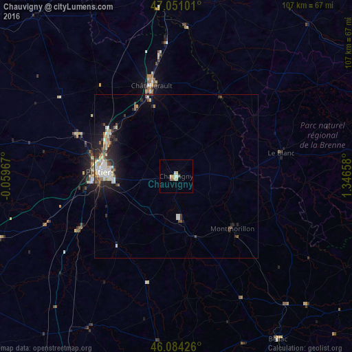
Analysis of Chauvigny night lights 2016
Square area 10x10 km:
 0.43%
0.43%90-99
1.85%80-89
1.7%70-79
0%60-69
2.13%50-59
0.14%40-49
0%30-39
0%20-29
0%10-19
0%0-9
93.75%Square area 50x50 km:
0.69%90-99
0.82%80-89
0.36%70-79
0.3%60-69
0.42%50-59
0.41%40-49
0.4%30-39
0.42%20-29
1.28%10-19
2.46%0-9
92.45%Clear (daylight) street map image can be seen on geolist.org.
Map coordinates:
47° 3' 3.6" North, 0° 3' 34.8" West
46° 34' 11.2" North, 0° 38' 36.5" East
46° 5' 3.3" North, 1° 20' 47.7" East
Some cities around Chauvigny sort by population:
• Poitiers
23 km =14.3 mi,  273°
273°
• Châtellerault
28.5 km =17.7 mi,  344°
344°
• Buxerolles
13.3 km =8.3 mi,  293°
293°
• Montmorillon
23.5 km =14.6 mi,  132°
132°
• Saint-Benoît
23.2 km =14.4 mi,  264°
264°
• Migné
25.9 km =16.1 mi,  284°
284°
• Jaunay-Clan
24.4 km =15.2 mi,  301°
301°
• Naintré
24.7 km =15.3 mi,  330°
330°
3025809 (p: 7,526)
Sources (retrieved 2019-11-25):
» Earth at Night: Flat Maps 2012, 2016