Quiévrechain night lights from space
Night Light of Quiévrechain (Hauts-de-France) from space (France) Src. Average luminocity for 10x10km area is 29.1751% and for 50x50km: 28.1682%.
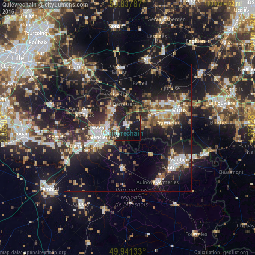
Analysis of Quiévrechain night lights 2016
Square area 10x10 km:
 3.5%
3.5%90-99
5.46%80-89
1.4%70-79
2.24%60-69
3.64%50-59
3.78%40-49
3.64%30-39
2.38%20-29
16.53%10-19
39.22%0-9
18.21%Square area 50x50 km:
3.88%90-99
4.65%80-89
2.71%70-79
2.64%60-69
3.66%50-59
4.02%40-49
4.63%30-39
5.37%20-29
11.43%10-19
20.56%0-9
36.46%Clear (daylight) street map image can be seen on geolist.org.
Map coordinates:
50° 50' 16.3" North, 2° 57' 54.1" East
50° 23' 30.2" North, 3° 40' 5.3" East
49° 56' 28.8" North, 4° 22' 16.6" East
Some cities around Quiévrechain sort by population:
• Dour, BE
7.8 km =4.8 mi,  86°
86°
• Bruay-sur-l’Escaut
8.9 km =5.5 mi,  275°
275°
• Bernissart, BE
9.3 km =5.8 mi,  351°
351°
• Saint-Saulve
8.3 km =5.2 mi,  254°
254°
• Condé-sur-l’Escaut
8.9 km =5.5 mi,  321°
321°
• Onnaing
4.9 km =3 mi,  262°
262°
• Fresnes-sur-Escaut
7.9 km =4.9 mi,  306°
306°
• Hensies, BE
4.7 km =2.9 mi,  13°
13°
2984728 (p: 6,201)
Sources (retrieved 2019-11-25):
» Earth at Night: Flat Maps 2012, 2016