Pecquencourt night lights from space
Night Light of Pecquencourt (Hauts-de-France) from space (France) Src. Average luminocity for 10x10km area is 51.2675% and for 50x50km: 36.7774%.
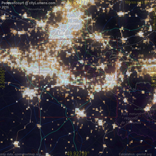
Analysis of Pecquencourt night lights 2016
Square area 10x10 km:
 7.42%
7.42%90-99
11.2%80-89
6.58%70-79
4.2%60-69
6.44%50-59
4.76%40-49
10.08%30-39
14.85%20-29
26.19%10-19
8.26%0-9
0%Square area 50x50 km:
6.86%90-99
7.89%80-89
3.46%70-79
3.55%60-69
5.06%50-59
4.4%40-49
5.17%30-39
6.43%20-29
11.97%10-19
19.01%0-9
26.2%Clear (daylight) street map image can be seen on geolist.org.
Map coordinates:
50° 49' 29.2" North, 2° 30' 34.7" East
50° 22' 42.6" North, 3° 12' 46" East
49° 55' 40.8" North, 3° 54' 57.2" East
Some cities around Pecquencourt sort by population:
• Sin-le-Noble
6.1 km =3.8 mi,  252°
252°
• Somain
5.3 km =3.3 mi,  113°
113°
• Aniche
6.1 km =3.8 mi,  151°
151°
• Waziers
7 km =4.3 mi,  277°
277°
• Lallaing
3.3 km =2.1 mi,  292°
292°
• Flines-lez-Raches
4.7 km =2.9 mi,  333°
333°
• Dechy
7.5 km =4.7 mi, 245°
• Fenain
6.3 km =3.9 mi,  102°
102°
2988236 (p: 6,703)
Sources (retrieved 2019-11-25):
» Earth at Night: Flat Maps 2012, 2016