Milhaud night lights from space
Night Light of Milhaud (Occitanie) from space (France) Src. Average luminocity for 10x10km area is 48.7894% and for 50x50km: 18.3649%.
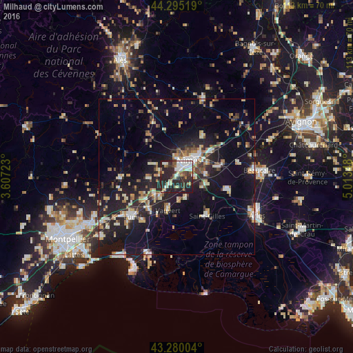
Analysis of Milhaud night lights 2016
Square area 10x10 km:
 9.7%
9.7%90-99
11.52%80-89
6.82%70-79
1.67%60-69
4.55%50-59
4.85%40-49
6.36%30-39
6.52%20-29
35.15%10-19
12.88%0-9
0%Square area 50x50 km:
1.8%90-99
3.26%80-89
2.28%70-79
1.79%60-69
2.41%50-59
1.97%40-49
2.23%30-39
1.83%20-29
7.44%10-19
16.17%0-9
58.82%Clear (daylight) street map image can be seen on geolist.org.
Map coordinates:
44° 17' 42.7" North, 3° 36' 26" East
43° 47' 23.2" North, 4° 18' 37.3" East
43° 16' 48.1" North, 5° 0' 48.5" East
Some cities around Milhaud sort by population:
• Nîmes
6.3 km =3.9 mi,  38°
38°
• Saint-Gilles
15.9 km =9.9 mi,  142°
142°
• Vauvert
10.8 km =6.7 mi,  194°
194°
• Marguerittes
13.3 km =8.3 mi,  54°
54°
• Manduel
13.4 km =8.3 mi,  76°
76°
• Marsillargues
17.7 km =11 mi,  218°
218°
• Bouillargues
9.5 km =5.9 mi, 84°
• Bellegarde
17 km =10.6 mi,  103°
103°
2993889 (p: 5,321)
Sources (retrieved 2019-11-25):
» Earth at Night: Flat Maps 2012, 2016