Marguerittes night lights from space
Night Light of Marguerittes (Occitanie) from space (France) Src. Average luminocity for 10x10km area is 43.3% and for 50x50km: 19.1802%.
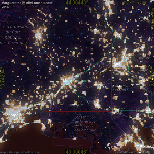
Analysis of Marguerittes night lights 2016
Square area 10x10 km:
 6.51%
6.51%90-99
10.63%80-89
3.33%70-79
1.75%60-69
9.05%50-59
4.76%40-49
7.94%30-39
7.46%20-29
16.35%10-19
24.44%0-9
7.78%Square area 50x50 km:
1.82%90-99
3.24%80-89
2.5%70-79
2.02%60-69
2.27%50-59
2.14%40-49
2.45%30-39
1.66%20-29
6.54%10-19
17.81%0-9
57.55%Clear (daylight) street map image can be seen on geolist.org.
Map coordinates:
44° 21' 51.9" North, 3° 44' 31.3" East
43° 51' 34.6" North, 4° 26' 42.6" East
43° 21' 1.7" North, 5° 8' 53.8" East
Some cities around Marguerittes sort by population:
• Nîmes
7.4 km =4.6 mi,  247°
247°
• Beaucaire
17 km =10.6 mi,  109°
109°
• Tarascon
18.3 km =11.4 mi, 109°
• Uzès
17.3 km =10.7 mi,  352°
352°
• Manduel
5.1 km =3.2 mi,  154°
154°
• Bouillargues
7.1 km =4.4 mi,  190°
190°
• Bellegarde
13.1 km =8.1 mi, 154°
• Milhaud
13.3 km =8.3 mi,  234°
234°
2995782 (p: 8,974)
Sources (retrieved 2019-11-25):
» Earth at Night: Flat Maps 2012, 2016