Mennecy night lights from space
Night Light of Mennecy (Île-de-France) from space (France) Src. Average luminocity for 10x10km area is 48.5789% and for 50x50km: 38.9463%.
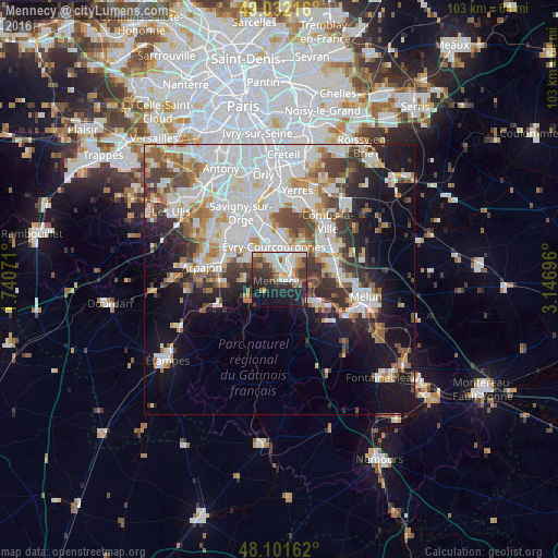
Analysis of Mennecy night lights 2016
Square area 10x10 km:
 12.5%
12.5%90-99
11.16%80-89
1.79%70-79
4.61%60-69
6.7%50-59
4.46%40-49
5.36%30-39
10.57%20-29
18.01%10-19
18.9%0-9
5.95%Square area 50x50 km:
12.3%90-99
9.64%80-89
2.98%70-79
3.58%60-69
4.22%50-59
3.5%40-49
4.3%30-39
4.43%20-29
5.94%10-19
12.52%0-9
36.58%Clear (daylight) street map image can be seen on geolist.org.
Map coordinates:
49° 1' 55.8" North, 1° 44' 26.6" East
48° 34' 8.5" North, 2° 26' 37.8" East
48° 6' 5.8" North, 3° 8' 49.1" East
Some cities around Mennecy sort by population:
• Corbeil-Essonnes
5.2 km =3.2 mi,  38°
38°
• Courcouronnes
5.7 km =3.5 mi,  332°
332°
• Saint-Fargeau-Ponthierry
6.4 km =4 mi,  102°
102°
• Lisses
4 km =2.5 mi,  336°
336°
• Ballancourt-sur-Essonne
6.5 km =4 mi,  221°
221°
• Saint-Pierre-du-Perray
5.9 km =3.7 mi, 38°
• Saintry-sur-Seine
4.8 km =3 mi,  51°
51°
• Villabé
2.3 km =1.4 mi,  12°
12°
2994534 (p: 14,646)
Sources (retrieved 2019-11-25):
» Earth at Night: Flat Maps 2012, 2016