Marles-les-Mines night lights from space
Night Light of Marles-les-Mines (Hauts-de-France) from space (France) Src. Average luminocity for 10x10km area is 57.2927% and for 50x50km: 21.1824%.
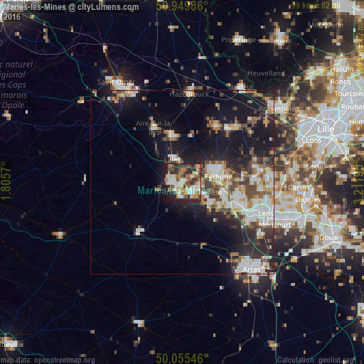
Analysis of Marles-les-Mines night lights 2016
Square area 10x10 km:
 8.54%
8.54%90-99
12.04%80-89
9.66%70-79
8.26%60-69
9.1%50-59
6.86%40-49
10.64%30-39
6.72%20-29
18.49%10-19
9.38%0-9
0.28%Square area 50x50 km:
3.63%90-99
4.41%80-89
2.2%70-79
2.14%60-69
2.45%50-59
2.48%40-49
3.28%30-39
3.25%20-29
6.45%10-19
14.23%0-9
55.47%Clear (daylight) street map image can be seen on geolist.org.
Map coordinates:
50° 56' 59.5" North, 1° 48' 20.5" East
50° 30' 17.2" North, 2° 30' 31.8" East
50° 3' 19.7" North, 3° 12' 43" East
Some cities around Marles-les-Mines sort by population:
• Bruay-la-Buissière
3.8 km =2.4 mi,  129°
129°
• Auchel
2.5 km =1.6 mi,  266°
266°
• Lillers
6.8 km =4.2 mi,  342°
342°
• Houdain
6.4 km =4 mi,  161°
161°
• Divion
3.7 km =2.3 mi,  183°
183°
• Calonne-Ricouart
3.3 km =2.1 mi,  228°
228°
• Annezin
8.3 km =5.2 mi,  68°
68°
• Haillicourt
5.7 km =3.5 mi, 125°
2995669 (p: 6,198)
Sources (retrieved 2019-11-25):
» Earth at Night: Flat Maps 2012, 2016