Épernon night lights from space
Night Light of Épernon (Centre) from space (France) Src. Average luminocity for 10x10km area is 9.0223% and for 50x50km: 12.6186%.
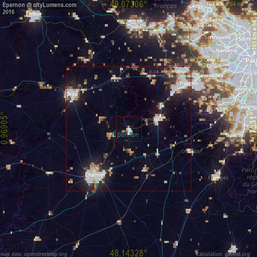
Analysis of Épernon night lights 2016
Square area 10x10 km:
 1.19%
1.19%90-99
2.38%80-89
0.6%70-79
0%60-69
1.19%50-59
0.6%40-49
1.79%30-39
0.89%20-29
0.15%10-19
0.74%0-9
90.48%Square area 50x50 km:
2.29%90-99
2.54%80-89
1.06%70-79
1.1%60-69
1.58%50-59
1.15%40-49
1.57%30-39
1.49%20-29
2.75%10-19
8.34%0-9
76.13%Clear (daylight) street map image can be seen on geolist.org.
Map coordinates:
49° 4' 23" North, 0° 58' 8.6" East
48° 36' 37.1" North, 1° 40' 19.8" East
48° 8' 35.8" North, 2° 22' 31.1" East
Some cities around Épernon sort by population:
• Chartres
22.6 km =14 mi,  216°
216°
• Rambouillet
12.2 km =7.6 mi,  72°
72°
• Lucé
24.7 km =15.3 mi, 218°
• Mainvilliers
23.9 km =14.9 mi, 221°
• Luisant
24.9 km =15.5 mi, 216°
• Les Essarts-le-Roi
20.5 km =12.7 mi,  54°
54°
• Le Perray-en-Yvelines
16.5 km =10.3 mi,  55°
55°
• Saint-Arnoult-en-Yvelines
20.1 km =12.5 mi,  102°
102°
3020057 (p: 5,266)
Sources (retrieved 2019-11-25):
» Earth at Night: Flat Maps 2012, 2016