Rambouillet night lights from space
Night Light of Rambouillet (Île-de-France) from space (France) Src. Average luminocity for 10x10km area is 21.6949% and for 50x50km: 17.9864%.
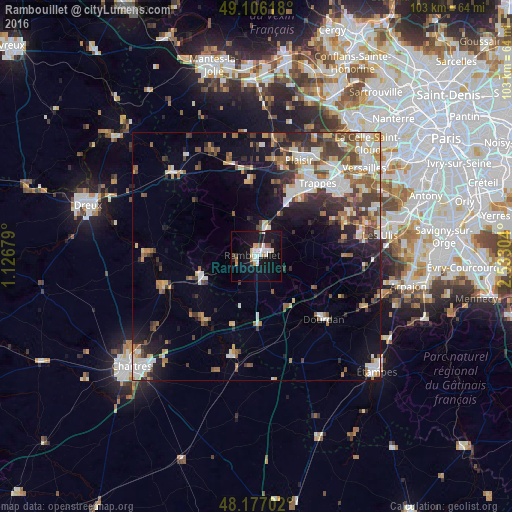
Analysis of Rambouillet night lights 2016
Square area 10x10 km:
 5.51%
5.51%90-99
3.27%80-89
2.23%70-79
1.79%60-69
1.79%50-59
0.74%40-49
1.79%30-39
1.34%20-29
1.19%10-19
31.25%0-9
49.11%Square area 50x50 km:
3.09%90-99
3.66%80-89
1.8%70-79
1.73%60-69
2.57%50-59
2.27%40-49
2.88%30-39
2.88%20-29
3.24%10-19
7.74%0-9
68.13%Clear (daylight) street map image can be seen on geolist.org.
Map coordinates:
49° 6' 22.2" North, 1° 7' 36.4" East
48° 38' 37.5" North, 1° 49' 47.7" East
48° 10' 37.3" North, 2° 31' 58.9" East
Some cities around Rambouillet sort by population:
• Maurepas
15.3 km =9.5 mi,  28°
28°
• Le Mesnil-Saint-Denis
14.6 km =9.1 mi,  39°
39°
• La Verrière
14.8 km =9.2 mi, 35°
• Les Essarts-le-Roi
9.6 km =6 mi, 32°
• Le Perray-en-Yvelines
6 km =3.7 mi,  19°
19°
• Saint-Arnoult-en-Yvelines
11.4 km =7.1 mi,  135°
135°
• Chevreuse
16.5 km =10.3 mi,  64°
64°
• Épernon
12.2 km =7.6 mi,  252°
252°
2984513 (p: 26,674)
Sources (retrieved 2019-11-25):
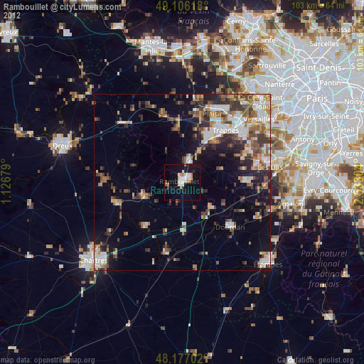
» Earth at Night: Flat Maps 2012, 2016