Louhans night lights from space
Night Light of Louhans (Bourgogne-Franche-Comté) from space (France) Src. Average luminocity for 10x10km area is 4.1705% and for 50x50km: 1.4086%.
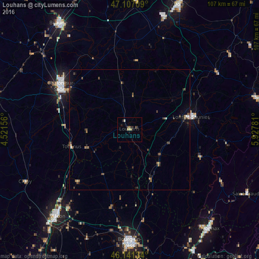
Analysis of Louhans night lights 2016
Square area 10x10 km:
 0%
0%90-99
0.57%80-89
0.57%70-79
1.14%60-69
0.57%50-59
0.57%40-49
0.57%30-39
1.85%20-29
0.43%10-19
0.57%0-9
93.18%Square area 50x50 km:
0.09%90-99
0.08%80-89
0.12%70-79
0.15%60-69
0.28%50-59
0.32%40-49
0.32%30-39
0.38%20-29
0.21%10-19
0.76%0-9
97.32%Clear (daylight) street map image can be seen on geolist.org.
Map coordinates:
47° 6' 25.5" North, 4° 31' 17.6" East
46° 37' 34.9" North, 5° 13' 28.8" East
46° 8' 28.8" North, 5° 55' 40.1" East
Some cities around Louhans sort by population:
• Chalon-sur-Saône
33.1 km =20.6 mi,  301°
301°
• Bourg-en-Bresse
46.8 km =29.1 mi,  179°
179°
• Mâcon
46.1 km =28.6 mi,  221°
221°
• Lons-le-Saunier
25.8 km =16 mi,  77°
77°
• Tournus
25.2 km =15.7 mi,  254°
254°
• Châtenoy-le-Royal
36.8 km =22.9 mi, 301°
• Saint-Rémy
33.1 km =20.6 mi, 297°
• Viriat
41.3 km =25.7 mi, 180°
2997439 (p: 6,466)
Sources (retrieved 2019-11-25):
» Earth at Night: Flat Maps 2012, 2016