Le Thor night lights from space
Night Light of Le Thor (Provence-Alpes-Côte d'Azur) from space (France) Src. Average luminocity for 10x10km area is 29.3381% and for 50x50km: 20.2973%.
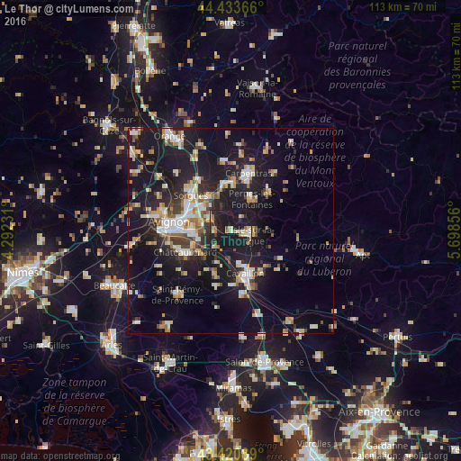
Analysis of Le Thor night lights 2016
Square area 10x10 km:
 1.43%
1.43%90-99
3.97%80-89
5.71%70-79
3.02%60-69
4.44%50-59
3.33%40-49
1.11%30-39
2.7%20-29
6.83%10-19
66.67%0-9
0.79%Square area 50x50 km:
2.45%90-99
3.81%80-89
2.59%70-79
2.36%60-69
2.27%50-59
2.01%40-49
2.03%30-39
2.32%20-29
5.35%10-19
24.23%0-9
50.59%Clear (daylight) street map image can be seen on geolist.org.
Map coordinates:
44° 26' 1.2" North, 4° 17' 32.3" East
43° 55' 45.9" North, 4° 59' 43.5" East
43° 25' 15.2" North, 5° 41' 54.8" East
Some cities around Le Thor sort by population:
• Cavaillon
11.4 km =7.1 mi,  163°
163°
• L’Isle-sur-la-Sorgue
4.6 km =2.9 mi,  103°
103°
• Le Pontet
11.4 km =7.1 mi,  288°
288°
• Montfavet
9.8 km =6.1 mi,  272°
272°
• Pernes-les-Fontaines
9.2 km =5.7 mi,  33°
33°
• Vedène
9 km =5.6 mi,  306°
306°
• Entraigues-sur-la-Sorgue
9.9 km =6.2 mi,  326°
326°
• Morières-lès-Avignon
7.6 km =4.7 mi,  279°
279°
2999180 (p: 7,055)
Sources (retrieved 2019-11-25):
» Earth at Night: Flat Maps 2012, 2016