Le Pontet night lights from space
Night Light of Le Pontet (Provence-Alpes-Côte d'Azur) from space (France) Src. Average luminocity for 10x10km area is 73.5873% and for 50x50km: 23.582%.
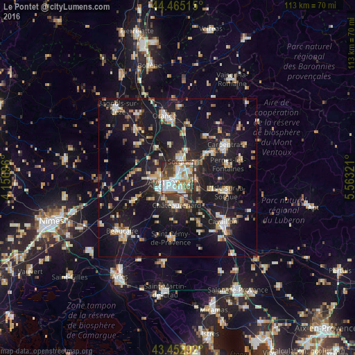
Analysis of Le Pontet night lights 2016
Square area 10x10 km:
 23.33%
90-99
21.43%80-89
4.92%70-79
6.51%60-69
9.37%50-59
12.22%40-49
6.98%30-39
8.89%20-29
6.35%10-19
0%0-9
0%Square area 50x50 km:
2.8%90-99
4.2%80-89
2.83%70-79
2.68%60-69
2.74%50-59
2.36%40-49
2.57%30-39
2.55%20-29
5.79%10-19
30.77%0-9
40.71%Clear (daylight) street map image can be seen on geolist.org.
Map coordinates:
44° 27' 54.5" North, 4° 9' 25.1" East
43° 57' 40.3" North, 4° 51' 36.3" East
43° 27' 10.5" North, 5° 33' 47.6" East
Some cities around Le Pontet sort by population:
• Avignon
4.3 km =2.7 mi,  250°
250°
• Sorgues
5.6 km =3.5 mi,  11°
11°
• Montfavet
3.3 km =2.1 mi,  160°
160°
• Villeneuve-lès-Avignon
5.2 km =3.2 mi,  278°
278°
• Vedène
4 km =2.5 mi,  62°
62°
• Les Angles
7.7 km =4.8 mi,  267°
267°
• Entraigues-sur-la-Sorgue
7.1 km =4.4 mi,  48°
48°
• Morières-lès-Avignon
4 km =2.5 mi,  125°
125°
3002570 (p: 16,182)
Sources (retrieved 2019-11-25):
» Earth at Night: Flat Maps 2012, 2016