Le Pont-de-Claix night lights from space
Night Light of Le Pont-de-Claix (Auvergne-Rhône-Alpes) from space (France) Src. Average luminocity for 10x10km area is 52.2636% and for 50x50km: 10.7621%.
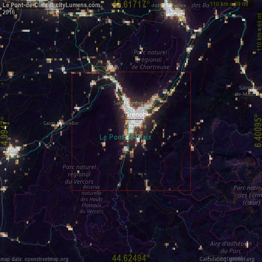
Analysis of Le Pont-de-Claix night lights 2016
Square area 10x10 km:
 12.73%
90-99
13.03%80-89
5.76%70-79
3.94%60-69
3.94%50-59
5.61%40-49
6.21%30-39
9.09%20-29
20%10-19
18.33%0-9
1.36%Square area 50x50 km:
2.07%90-99
1.88%80-89
0.86%70-79
0.92%60-69
0.97%50-59
1.52%40-49
1.29%30-39
2.13%20-29
3.45%10-19
7.71%0-9
77.22%Clear (daylight) street map image can be seen on geolist.org.
Map coordinates:
45° 37' 1.8" North, 4° 59' 40.9" East
45° 7' 23.6" North, 5° 41' 52.2" East
44° 37' 29.8" North, 6° 24' 3.4" East
Some cities around Le Pont-de-Claix sort by population:
• Grenoble
6.3 km =3.9 mi,  12°
12°
• Échirolles
2.9 km =1.8 mi,  27°
27°
• Seyssinet-Pariset
6 km =3.7 mi,  357°
357°
• Eybens
4.9 km =3 mi,  56°
56°
• Claix
2 km =1.2 mi,  259°
259°
• Vizille
7.6 km =4.7 mi,  131°
131°
• Seyssins
4.4 km =2.7 mi,  348°
348°
• Allières-et-Risset
3 km =1.9 mi,  208°
208°
3002585 (p: 11,963)
Sources (retrieved 2019-11-25):
» Earth at Night: Flat Maps 2012, 2016