Le Poiré-sur-Vie night lights from space
Night Light of Le Poiré-sur-Vie (Pays de la Loire) from space (France) Src. Average luminocity for 10x10km area is 2.8795% and for 50x50km: 4.0215%.
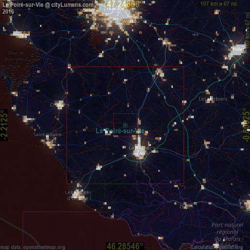
Analysis of Le Poiré-sur-Vie night lights 2016
Square area 10x10 km:
 0%
0%90-99
0%80-89
0.3%70-79
0.6%60-69
0.3%50-59
0.15%40-49
0.74%30-39
0%20-29
0%10-19
3.87%0-9
94.05%Square area 50x50 km:
0.57%90-99
0.7%80-89
0.3%70-79
0.4%60-69
0.54%50-59
0.53%40-49
0.59%30-39
0.44%20-29
0.94%10-19
2.71%0-9
92.29%Clear (daylight) street map image can be seen on geolist.org.
Map coordinates:
47° 14' 55.2" North, 2° 12' 45" West
46° 46' 9.2" North, 1° 30' 33.8" West
46° 17' 7.7" North, 0° 48' 22.5" West
Some cities around Le Poiré-sur-Vie sort by population:
• La Roche-sur-Yon
12.8 km =8 mi,  153°
153°
• Challans
29 km =18 mi,  286°
286°
• Olonne-sur-Mer
32.9 km =20.4 mi,  217°
217°
• Saint-Hilaire-de-Riez
32.3 km =20.1 mi,  258°
258°
• Saint-Philbert-de-Grand-Lieu
31.3 km =19.4 mi,  341°
341°
• Aizenay
8.2 km =5.1 mi,  246°
246°
• Saint-Hilaire-de-Talmont
34 km =21.1 mi,  192°
192°
• Montaigu
27.7 km =17.2 mi,  33°
33°
3002620 (p: 6,273)
Sources (retrieved 2019-11-25):
» Earth at Night: Flat Maps 2012, 2016