La Verrière night lights from space
Night Light of La Verrière (Île-de-France) from space (France) Src. Average luminocity for 10x10km area is 47.119% and for 50x50km: 36.6399%.
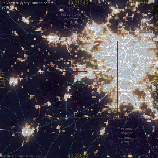
Analysis of La Verrière night lights 2016
Square area 10x10 km:
 12.5%
12.5%90-99
13.39%80-89
2.98%70-79
2.08%60-69
4.46%50-59
1.93%40-49
4.61%30-39
9.08%20-29
17.71%10-19
29.46%0-9
1.79%Square area 50x50 km:
10.34%90-99
8.92%80-89
3.25%70-79
3.29%60-69
4.43%50-59
3.74%40-49
4.89%30-39
4.02%20-29
5.73%10-19
10.34%0-9
41.05%Clear (daylight) street map image can be seen on geolist.org.
Map coordinates:
49° 12' 48.4" North, 1° 14' 36.1" East
48° 45' 7.2" North, 1° 56' 47.4" East
48° 17' 10.6" North, 2° 38' 58.6" East
Some cities around La Verrière sort by population:
• Saint-Quentin-en-Yvelines
5.7 km =3.5 mi,  67°
67°
• Montigny-le-Bretonneux
6.6 km =4.1 mi,  76°
76°
• Élancourt
3.6 km =2.2 mi,  10°
10°
• Trappes
5.8 km =3.6 mi,  64°
64°
• Maurepas
1.9 km =1.2 mi,  318°
318°
• Le Mesnil-Saint-Denis
1.1 km =0.7 mi,  138°
138°
• Les Essarts-le-Roi
5.2 km =3.2 mi,  220°
220°
• Jouars-Pontchartrain
5.4 km =3.4 mi, 319°
3005639 (p: 6,427)
Sources (retrieved 2019-11-25):
» Earth at Night: Flat Maps 2012, 2016