Gretz-Armainvilliers night lights from space
Night Light of Gretz-Armainvilliers (Île-de-France) from space (France) Src. Average luminocity for 10x10km area is 30.0164% and for 50x50km: 41.4687%.
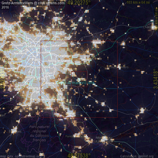
Analysis of Gretz-Armainvilliers night lights 2016
Square area 10x10 km:
 3.57%
3.57%90-99
8.33%80-89
1.64%70-79
3.57%60-69
2.08%50-59
2.68%40-49
1.93%30-39
1.64%20-29
10.27%10-19
47.92%0-9
16.37%Square area 50x50 km:
16.82%90-99
9.82%80-89
2.73%70-79
2.89%60-69
3.37%50-59
3%40-49
3.65%30-39
4.75%20-29
5.85%10-19
8.05%0-9
39.07%Clear (daylight) street map image can be seen on geolist.org.
Map coordinates:
49° 12' 9.9" North, 2° 1' 40.5" East
48° 44' 28.3" North, 2° 43' 51.8" East
48° 16' 31.4" North, 3° 26' 3" East
Some cities around Gretz-Armainvilliers sort by population:
• Pontault-Combault
11.1 km =6.9 mi,  304°
304°
• Ozoir-la-Ferrière
5.4 km =3.4 mi, 302°
• Roissy-en-Brie
8.3 km =5.2 mi,  312°
312°
• Brie-Comte-Robert
10.3 km =6.4 mi,  238°
238°
• Lésigny
8.5 km =5.3 mi,  271°
271°
• Tournan-en-Brie
3 km =1.9 mi,  89°
89°
• Émerainville
11.3 km =7 mi, 314°
• Fontenay-Trésigny
10.9 km =6.8 mi,  110°
110°
3014697 (p: 7,831)
Sources (retrieved 2019-11-25):
» Earth at Night: Flat Maps 2012, 2016