Creil night lights from space
Night Light of Creil (Hauts-de-France) from space (France) Src. Average luminocity for 10x10km area is 48.8102% and for 50x50km: 20.3227%.
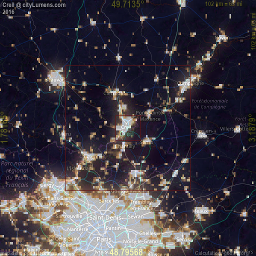
Analysis of Creil night lights 2016
Square area 10x10 km:
 13.37%
90-99
12.83%80-89
3.88%70-79
3.61%60-69
3.48%50-59
3.21%40-49
3.21%30-39
8.02%20-29
22.33%10-19
20.99%0-9
5.08%Square area 50x50 km:
2.72%90-99
3.22%80-89
1.73%70-79
1.76%60-69
2.57%50-59
2.33%40-49
2.73%30-39
3.53%20-29
7.86%10-19
20.1%0-9
51.47%Clear (daylight) street map image can be seen on geolist.org.
Map coordinates:
49° 42' 48.6" North, 1° 46' 53.9" East
49° 15' 24.2" North, 2° 29' 5.2" East
48° 47' 44.4" North, 3° 11' 16.4" East
Some cities around Creil sort by population:
• Nogent-sur-Oise
1.9 km =1.2 mi,  328°
328°
• Senlis
9.2 km =5.7 mi,  126°
126°
• Pont-Sainte-Maxence
10 km =6.2 mi,  60°
60°
• Montataire
3.4 km =2.1 mi,  274°
274°
• Chantilly
7 km =4.3 mi,  188°
188°
• Gouvieux
9.3 km =5.8 mi,  213°
213°
• Liancourt
8.3 km =5.2 mi,  350°
350°
• Villers-Saint-Paul
3.6 km =2.2 mi,  5°
5°
3022610 (p: 31,863)
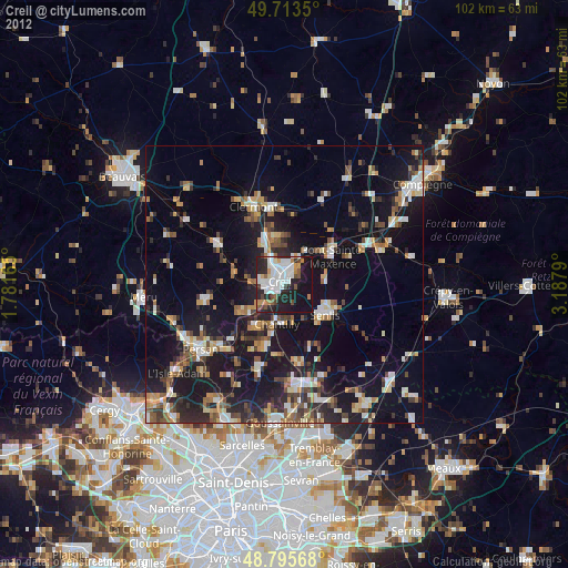
Sources (retrieved 2019-11-25):
» Earth at Night: Flat Maps 2012, 2016