Château-d’Olonne night lights from space
Night Light of Château-d’Olonne (Pays de la Loire) from space (France) Src. Average luminocity for 10x10km area is 19.0455% and for 50x50km: 3.1965%.
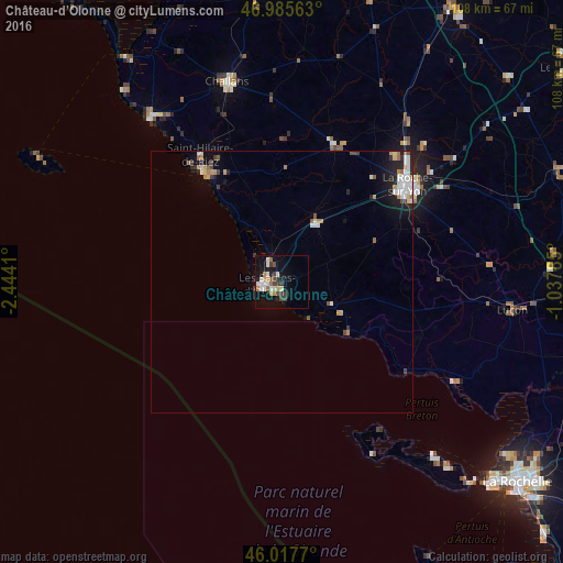
Analysis of Château-d’Olonne night lights 2016
Square area 10x10 km:
 2.7%
2.7%90-99
4.4%80-89
0.85%70-79
3.27%60-69
1.85%50-59
1.28%40-49
2.27%30-39
4.83%20-29
0.99%10-19
16.05%0-9
61.51%Square area 50x50 km:
0.55%90-99
0.63%80-89
0.22%70-79
0.47%60-69
0.32%50-59
0.27%40-49
0.36%30-39
0.46%20-29
0.49%10-19
1.94%0-9
94.29%Clear (daylight) street map image can be seen on geolist.org.
Map coordinates:
46° 59' 8.3" North, 2° 26' 38.8" West
46° 30' 13.8" North, 1° 44' 27.5" West
46° 1' 3.7" North, 1° 2' 16.3" West
Some cities around Château-d’Olonne sort by population:
• La Roche-sur-Yon
29.7 km =18.5 mi,  52°
52°
• Les Sables-d’Olonne
3.4 km =2.1 mi,  256°
256°
• Olonne-sur-Mer
4.3 km =2.7 mi,  325°
325°
• Saint-Hilaire-de-Riez
27.2 km =16.9 mi, 328°
• Saint-Gilles-Croix-de-Vie
26.6 km =16.5 mi,  324°
324°
• Aizenay
28.2 km =17.5 mi,  21°
21°
• Le Poiré-sur-Vie
34.4 km =21.4 mi,  30°
30°
• Saint-Hilaire-de-Talmont
11.2 km =7 mi,  109°
109°
3026291 (p: 13,420)
Sources (retrieved 2019-11-25):
» Earth at Night: Flat Maps 2012, 2016