Carhaix-Plouguer night lights from space
Night Light of Carhaix-Plouguer (Brittany) from space (France) Src. Average luminocity for 10x10km area is 6.9702% and for 50x50km: 0.505%.
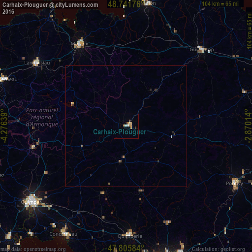
Analysis of Carhaix-Plouguer night lights 2016
Square area 10x10 km:
 1.04%
1.04%90-99
1.19%80-89
0.15%70-79
2.83%60-69
0.74%50-59
0.45%40-49
0.3%30-39
0.45%20-29
0.6%10-19
0%0-9
92.26%Square area 50x50 km:
0.05%90-99
0.08%80-89
0.01%70-79
0.15%60-69
0.1%50-59
0.04%40-49
0.06%30-39
0.08%20-29
0.16%10-19
0%0-9
99.28%Clear (daylight) street map image can be seen on geolist.org.
Map coordinates:
48° 44' 30.3" North, 4° 16' 35" West
48° 16' 33.4" North, 3° 34' 23.7" West
47° 48' 21" North, 2° 52' 12.5" West
Some cities around Carhaix-Plouguer sort by population:
• Morlaix
38.4 km =23.9 mi,  330°
330°
• Rosporden
39.4 km =24.5 mi,  209°
209°
• Scaër
28.6 km =17.8 mi,  199°
199°
• Châteaulin
39.3 km =24.4 mi,  257°
257°
• Plouay
44 km =27.3 mi,  156°
156°
• Bannalec
39.3 km =24.4 mi,  193°
193°
• Saint-Martin-des-Champs
39.2 km =24.4 mi, 330°
• Gourin
15.5 km =9.6 mi, 189°
3028603 (p: 8,270)
Sources (retrieved 2019-11-25):
» Earth at Night: Flat Maps 2012, 2016