Baillargues night lights from space
Night Light of Baillargues (Occitanie) from space (France) Src. Average luminocity for 10x10km area is 46.5652% and for 50x50km: 23.5195%.
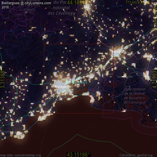
Analysis of Baillargues night lights 2016
Square area 10x10 km:
 6.97%
6.97%90-99
11.67%80-89
4.7%70-79
4.7%60-69
5.3%50-59
3.03%40-49
7.12%30-39
8.18%20-29
30%10-19
18.33%0-9
0%Square area 50x50 km:
4.1%90-99
4.91%80-89
2.85%70-79
2.31%60-69
2.51%50-59
1.87%40-49
1.99%30-39
3.04%20-29
9.33%10-19
19.21%0-9
47.88%Clear (daylight) street map image can be seen on geolist.org.
Map coordinates:
44° 10' 9" North, 3° 18' 49.2" East
43° 39' 45.6" North, 4° 1' 0.5" East
43° 9' 6.7" North, 4° 43' 11.7" East
Some cities around Baillargues sort by population:
• Lunel
9.7 km =6 mi,  80°
80°
• Mauguio
5 km =3.1 mi,  188°
188°
• Castelnau-le-Lez
9.9 km =6.2 mi,  250°
250°
• Le Crès
6.4 km =4 mi,  255°
255°
• Vendargues
3.8 km =2.4 mi, 262°
• Castries
3.4 km =2.1 mi,  304°
304°
• Clapiers
10.3 km =6.4 mi,  267°
267°
• Jacou
8.4 km =5.2 mi, 269°
3035370 (p: 6,570)
Sources (retrieved 2019-11-25):
» Earth at Night: Flat Maps 2012, 2016