Auxerre night lights from space
Night Light of Auxerre (Bourgogne-Franche-Comté) from space (France) Src. Average luminocity for 10x10km area is 31.7292% and for 50x50km: 3.221%.
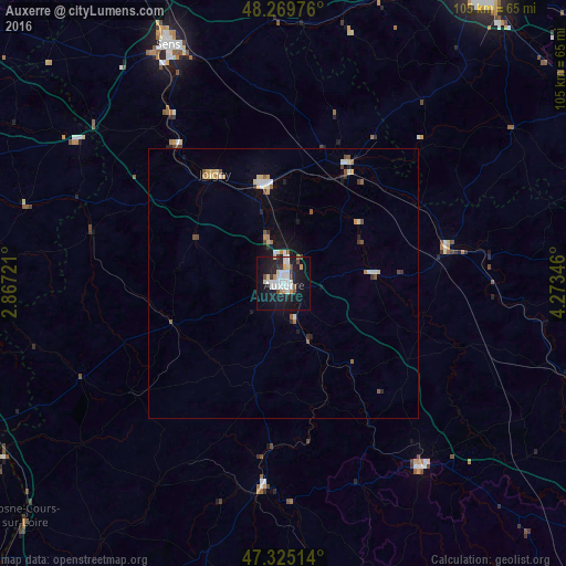
Analysis of Auxerre night lights 2016
Square area 10x10 km:
 8.63%
8.63%90-99
6.99%80-89
3.13%70-79
2.08%60-69
1.34%50-59
0.6%40-49
3.72%30-39
2.38%20-29
6.4%10-19
37.5%0-9
27.23%Square area 50x50 km:
0.53%90-99
0.53%80-89
0.41%70-79
0.31%60-69
0.25%50-59
0.32%40-49
0.46%30-39
0.29%20-29
0.42%10-19
2.3%0-9
94.19%Clear (daylight) street map image can be seen on geolist.org.
Map coordinates:
48° 16' 11.1" North, 2° 52' 2" East
47° 47' 58.6" North, 3° 34' 13.2" East
47° 19' 30.5" North, 4° 16' 24.5" East
Some cities around Auxerre sort by population:
• Sens
49.1 km =30.5 mi,  334°
334°
• Joigny
24 km =14.9 mi, 328°
• Avallon
42.7 km =26.5 mi,  143°
143°
• Migennes
18.9 km =11.7 mi,  348°
348°
• Saint-Florentin
25.1 km =15.6 mi,  27°
27°
• Villeneuve-sur-Yonne
37.5 km =23.3 mi, 327°
• Tonnerre
30.8 km =19.1 mi,  78°
78°
• Monéteau
5.6 km =3.5 mi,  8°
8°
3035843 (p: 41,516)
Sources (retrieved 2019-11-25):
» Earth at Night: Flat Maps 2012, 2016