Betton night lights from space
Night Light of Betton (Brittany) from space (France) Src. Average luminocity for 10x10km area is 16.9747% and for 50x50km: 5.9785%.
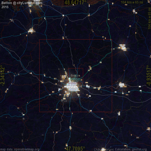
Analysis of Betton night lights 2016
Square area 10x10 km:
 2.08%
2.08%90-99
2.98%80-89
1.19%70-79
0.6%60-69
0.89%50-59
0.89%40-49
2.83%30-39
3.72%20-29
11.46%10-19
19.64%0-9
53.72%Square area 50x50 km:
1.55%90-99
1%80-89
0.38%70-79
0.42%60-69
0.39%50-59
0.58%40-49
0.86%30-39
1.08%20-29
2.02%10-19
3.48%0-9
88.25%Clear (daylight) street map image can be seen on geolist.org.
Map coordinates:
48° 38' 49.8" North, 2° 20' 29.1" West
48° 10' 49.7" North, 1° 38' 17.8" West
47° 42' 34.2" North, 0° 56' 6.6" West
Some cities around Betton sort by population:
• Rennes
8.1 km =5 mi,  199°
199°
• Cesson-Sévigné
7.1 km =4.4 mi,  158°
158°
• Saint-Grégoire
4.9 km =3 mi,  227°
227°
• Chantepie
10.3 km =6.4 mi,  170°
170°
• Liffré
10.3 km =6.4 mi,  69°
69°
• Fouillard
5 km =3.1 mi,  119°
119°
• Acigné
9.2 km =5.7 mi, 124°
• Melesse
5.9 km =3.7 mi,  314°
314°
3032965 (p: 9,343)
Sources (retrieved 2019-11-25):
» Earth at Night: Flat Maps 2012, 2016