Kauhajoki night lights from space
Night Light of Kauhajoki (Southern Ostrobothnia) from space (Finland) Src. Average luminocity for 10x10km area is 6.7065% and for 50x50km: 1.0512%.
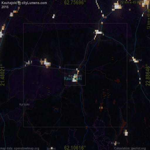
Analysis of Kauhajoki night lights 2016
Square area 10x10 km:
 0.99%
0.99%90-99
0.99%80-89
0%70-79
1.88%60-69
0.99%50-59
1.68%40-49
0.59%30-39
0.4%20-29
0%10-19
0.1%0-9
92.39%Square area 50x50 km:
0.14%90-99
0.19%80-89
0.04%70-79
0.12%60-69
0.18%50-59
0.19%40-49
0.15%30-39
0.14%20-29
0.02%10-19
0.09%0-9
98.74%Clear (daylight) street map image can be seen on geolist.org.
Map coordinates:
62° 45' 25.1" North, 21° 28' 48.8" East
62° 25' 60" North, 22° 10' 60" East
62° 6' 22.2" North, 22° 53' 11.3" East
Some cities around Kauhajoki sort by population:
• Seinäjoki
52 km =32.3 mi,  39°
39°
• Nurmo
57.5 km =35.7 mi, 40°
• Ilmajoki
38.7 km =24 mi,  30°
30°
• Kurikka
23.6 km =14.7 mi, 30°
• Jalasjärvi
30.1 km =18.7 mi,  75°
75°
• Kristinestad
45.3 km =28.1 mi,  246°
246°
• Teuva
23.3 km =14.5 mi,  283°
283°
• Ylistaro
58.7 km =36.5 mi,  16°
16°
653627 (p: 14,526)
Sources (retrieved 2019-11-25):
» Earth at Night: Flat Maps 2012, 2016