Ilmajoki night lights from space
Night Light of Ilmajoki (Southern Ostrobothnia) from space (Finland) Src. Average luminocity for 10x10km area is 12.0933% and for 50x50km: 3.8644%.
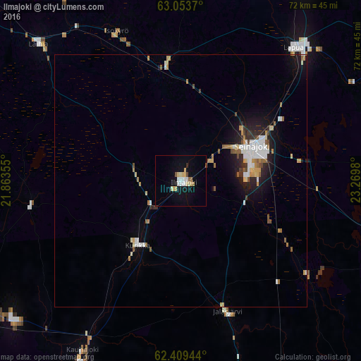
Analysis of Ilmajoki night lights 2016
Square area 10x10 km:
 2.18%
2.18%90-99
1.88%80-89
3.17%70-79
0.69%60-69
0.99%50-59
0.79%40-49
0.4%30-39
0.1%20-29
0.3%10-19
8.63%0-9
80.85%Square area 50x50 km:
0.64%90-99
0.76%80-89
0.5%70-79
0.38%60-69
0.39%50-59
0.47%40-49
0.28%30-39
0.23%20-29
0.79%10-19
2.57%0-9
92.99%Clear (daylight) street map image can be seen on geolist.org.
Map coordinates:
63° 3' 13.3" North, 21° 51' 48.8" East
62° 43' 60" North, 22° 34' 0" East
62° 24' 34" North, 23° 16' 11.3" East
Some cities around Ilmajoki sort by population:
• Seinäjoki
14.9 km =9.3 mi,  62°
62°
• Kauhajoki
38.7 km =24 mi,  210°
210°
• Lapua
34.5 km =21.4 mi,  40°
40°
• Nurmo
20.4 km =12.7 mi, 58°
• Kurikka
15.1 km =9.4 mi, 210°
• Jalasjärvi
27.6 km =17.1 mi,  160°
160°
• Ylistaro
23.1 km =14.4 mi,  353°
353°
• Isokyrö
33.1 km =20.6 mi,  339°
339°
656739 (p: 11,693)
Sources (retrieved 2019-11-25):
» Earth at Night: Flat Maps 2012, 2016