Hankasalmi night lights from space
Night Light of Hankasalmi (Central Finland) from space (Finland) Src. Average luminocity for 10x10km area is 4.334% and for 50x50km: 3.6903%.
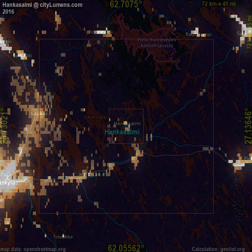
Analysis of Hankasalmi night lights 2016
Square area 10x10 km:
 0%
0%90-99
0%80-89
0.2%70-79
1.38%60-69
0%50-59
1.09%40-49
0.89%30-39
1.58%20-29
1.98%10-19
0.79%0-9
92.09%Square area 50x50 km:
0%90-99
0.03%80-89
0.03%70-79
0.3%60-69
0.51%50-59
1.47%40-49
1.58%30-39
1.62%20-29
0.44%10-19
1.45%0-9
92.58%Clear (daylight) street map image can be seen on geolist.org.
Map coordinates:
62° 42' 27" North, 25° 43' 48.8" East
62° 22' 60" North, 26° 25' 60" East
62° 3' 20.2" North, 27° 8' 11.3" East
Some cities around Hankasalmi sort by population:
• Jyväskylä
40 km =24.9 mi,  246°
246°
• Laukaa
25 km =15.5 mi,  277°
277°
• Äänekoski
43.3 km =26.9 mi,  303°
303°
• Pieksämäki
37.3 km =23.2 mi,  104°
104°
• Muurame
48.4 km =30.1 mi,  234°
234°
• Suonenjoki
44.3 km =27.5 mi,  54°
54°
• Kangasniemi
44.7 km =27.8 mi,  165°
165°
• Suolahti
35.9 km =22.3 mi, 304°
659024 (p: 5,372)
Sources (retrieved 2019-11-25):
» Earth at Night: Flat Maps 2012, 2016