Boticas night lights from space
Night Light of Boticas (Vila Real) from space (Portugal) Src. Average luminocity for 10x10km area is 7.2906% and for 50x50km: 4.6726%.
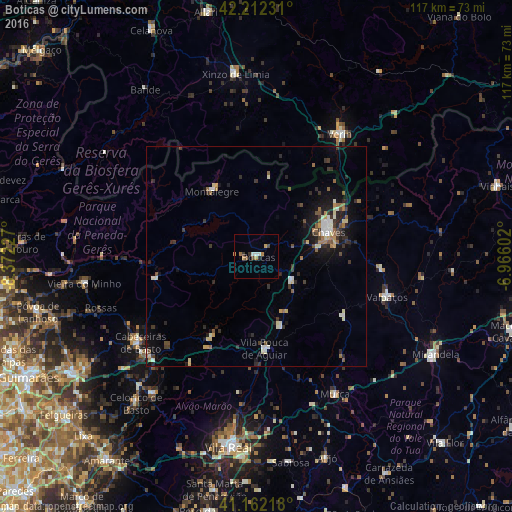
Analysis of Boticas night lights 2016
Square area 10x10 km:
 0.97%
0.97%90-99
0.97%80-89
0.16%70-79
1.46%60-69
1.62%50-59
0.97%40-49
1.3%30-39
0.65%20-29
0.65%10-19
0.65%0-9
90.58%Square area 50x50 km:
0.33%90-99
0.8%80-89
0.56%70-79
0.33%60-69
0.62%50-59
0.69%40-49
0.5%30-39
0.98%20-29
1.35%10-19
2.83%0-9
91%Clear (daylight) street map image can be seen on geolist.org.
Map coordinates:
42° 12' 44.3" North, 8° 22' 20.2" West
41° 41' 21.8" North, 7° 40' 8.9" West
41° 9' 43.8" North, 6° 57' 57.7" West
Some cities around Boticas sort by population:
• Chaves
17.6 km =10.9 mi,  71°
71°
• Vila Real
43.7 km =27.2 mi,  188°
188°
• Cabeceiras de Basto
33 km =20.5 mi,  233°
233°
• Verín, ES
33.9 km =21.1 mi,  34°
34°
• Mirandela
46 km =28.6 mi,  119°
119°
• Xinzo de Limia, ES
41.8 km =26 mi,  353°
353°
• Mondim de Basto
39 km =24.2 mi,  217°
217°
• Refojos de Basto
33.4 km =20.8 mi, 234°
2742090 (p: 5,750)
Sources (retrieved 2019-11-25):
» Earth at Night: Flat Maps 2012, 2016