Valdemoro night lights from space
Night Light of Valdemoro (Madrid) from space (Spain) Src. Average luminocity for 10x10km area is 47.7386% and for 50x50km: 38.8509%.
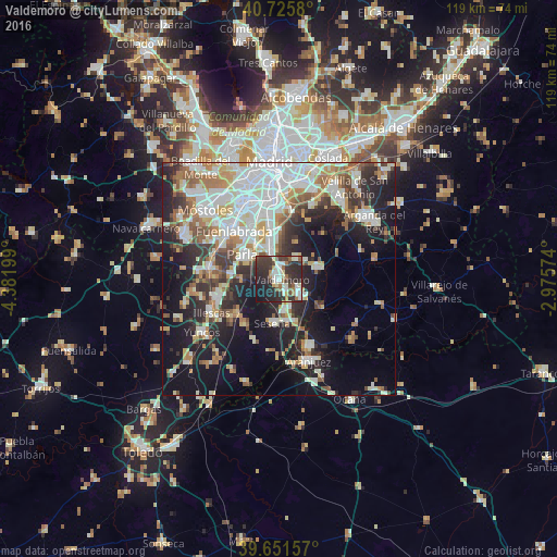
Analysis of Valdemoro night lights 2016
Square area 10x10 km:
 6.17%
6.17%90-99
12.82%80-89
4.71%70-79
2.44%60-69
6.82%50-59
4.71%40-49
4.06%30-39
15.42%20-29
29.22%10-19
13.15%0-9
0.49%Square area 50x50 km:
9.21%90-99
9.15%80-89
3.86%70-79
4.28%60-69
4.68%50-59
4.07%40-49
3.45%30-39
4.91%20-29
9.74%10-19
17.99%0-9
28.67%Clear (daylight) street map image can be seen on geolist.org.
Map coordinates:
40° 43' 32.9" North, 4° 22' 55.2" West
40° 11' 26.9" North, 3° 40' 43.9" West
39° 39' 5.7" North, 2° 58' 32.7" West
Some cities around Valdemoro sort by population:
• Fuenlabrada
14.3 km =8.9 mi,  316°
316°
• Getafe
13.6 km =8.5 mi,  340°
340°
• Parla
9.1 km =5.7 mi,  303°
303°
• Pinto
5.9 km =3.7 mi, 342°
• Ciempozuelos
6 km =3.7 mi,  125°
125°
• San Martín de la Vega
9.4 km =5.8 mi,  78°
78°
• Seseña
9.7 km =6 mi,  189°
189°
• Torrejón de la Calzada
10.1 km =6.3 mi,  275°
275°
3106868 (p: 62,750)
Sources (retrieved 2019-11-25):
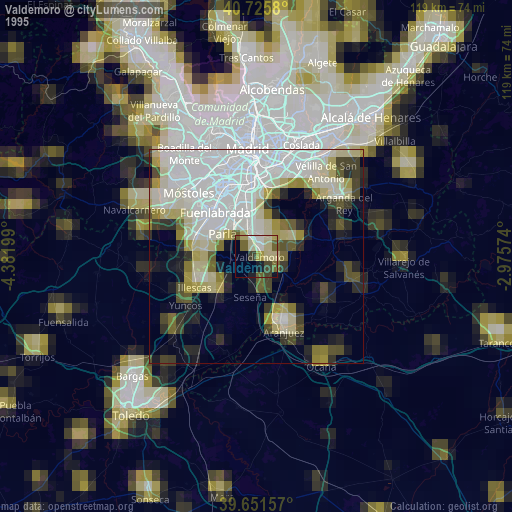
» NASA, Earths city lights 1995
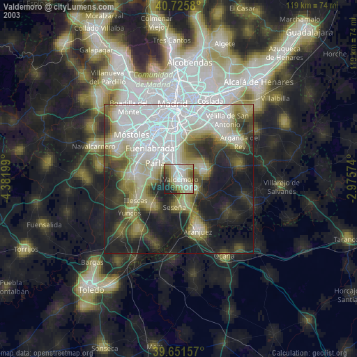
» NASA city lights 2003
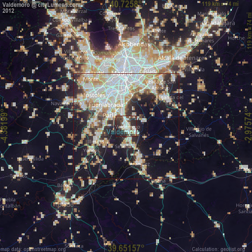
» Earth at Night: Flat Maps 2012, 2016