Valls night lights from space
Night Light of Valls (Catalonia) from space (Spain) Src. Average luminocity for 10x10km area is 28.2175% and for 50x50km: 18.6013%.
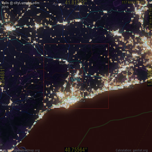
Analysis of Valls night lights 2016
Square area 10x10 km:
 3.73%
3.73%90-99
3.9%80-89
3.08%70-79
3.08%60-69
2.27%50-59
3.41%40-49
2.92%30-39
3.73%20-29
4.87%10-19
57.63%0-9
11.36%Square area 50x50 km:
2.5%90-99
3.37%80-89
2.39%70-79
2.36%60-69
2.35%50-59
2.74%40-49
1.63%30-39
2.87%20-29
5.83%10-19
12.86%0-9
61.1%Clear (daylight) street map image can be seen on geolist.org.
Map coordinates:
41° 48' 44.4" North, 0° 32' 48.5" East
41° 17' 10" North, 1° 14' 59.7" East
40° 45' 20.3" North, 1° 57' 11" East
Some cities around Valls sort by population:
• Tarragona
18.8 km =11.7 mi,  179°
179°
• Reus
18.8 km =11.7 mi,  219°
219°
• Vila-seca
21.3 km =13.2 mi,  203°
203°
• Torredembarra
20 km =12.4 mi,  141°
141°
• Montblanc
12.5 km =7.8 mi,  323°
323°
• La Canonja
19.2 km =11.9 mi, 197°
• Riudoms
23.8 km =14.8 mi, 224°
• Constantí
15 km =9.3 mi,  191°
191°
3106492 (p: 25,092)
Sources (retrieved 2019-11-25):
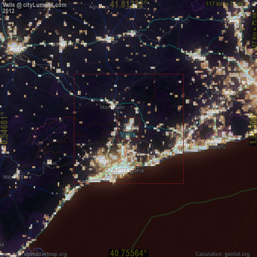
» Earth at Night: Flat Maps 2012, 2016