Sóller night lights from space
Night Light of Sóller (Balearic Islands) from space (Spain) Src. Average luminocity for 10x10km area is 6.8265% and for 50x50km: 8.3451%.
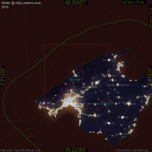
Analysis of Sóller night lights 2016
Square area 10x10 km:
 0%
0%90-99
0%80-89
2.04%70-79
1.87%60-69
1.53%50-59
0.51%40-49
1.53%30-39
0.68%20-29
0.68%10-19
0%0-9
91.16%Square area 50x50 km:
1.49%90-99
1.44%80-89
1.06%70-79
0.7%60-69
1.14%50-59
1.56%40-49
0.81%30-39
1.07%20-29
1.86%10-19
4.18%0-9
84.68%Clear (daylight) street map image can be seen on geolist.org.
Map coordinates:
40° 18' 16.5" North, 2° 0' 43.5" East
39° 45' 58.4" North, 2° 42' 54.8" East
39° 13' 25.1" North, 3° 25' 6" East
Some cities around Sóller sort by population:
• Palma
22.6 km =14 mi,  194°
194°
• Marratxí
16.1 km =10 mi,  176°
176°
• Inca
17.5 km =10.9 mi,  106°
106°
• Coll d'en Rabassa
24 km =14.9 mi, 184°
• Es Molinar
23 km =14.3 mi, 188°
• Binissalem
14.1 km =8.8 mi,  128°
128°
• Bunyola
7.9 km =4.9 mi, 189°
• Lloseta
14 km =8.7 mi, 112°
2510821 (p: 13,942)
Sources (retrieved 2019-11-25):
» Earth at Night: Flat Maps 2012, 2016