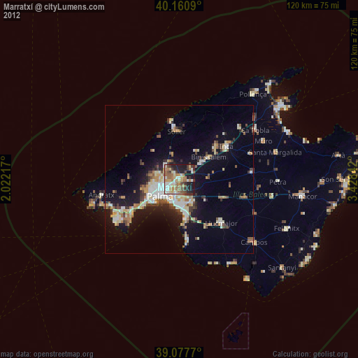
Marratxí night lights from space
Night Light of Marratxí (Balearic Islands) from space (Spain) Src. Average luminocity for 10x10km area is 49.9026% and for 50x50km: 12.3879%.
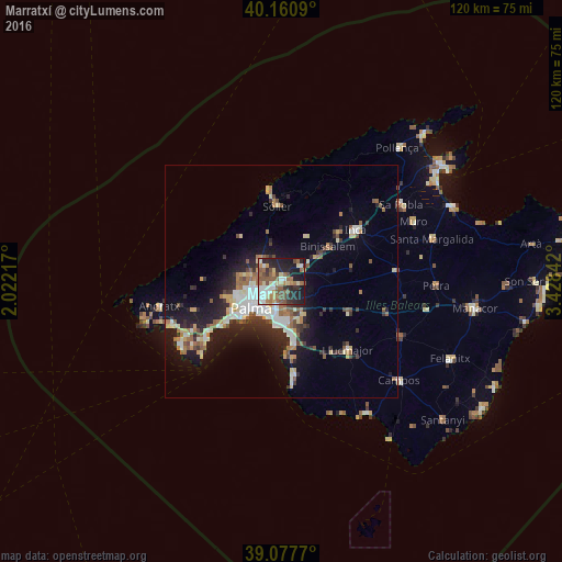
Analysis of Marratxí night lights 2016
Square area 10x10 km:
 7.79%
7.79%90-99
7.31%80-89
7.79%70-79
4.06%60-69
9.25%50-59
14.12%40-49
6.66%30-39
5.84%20-29
14.77%10-19
21.27%0-9
1.14%Square area 50x50 km:
1.94%90-99
1.99%80-89
1.53%70-79
1.12%60-69
1.67%50-59
2.08%40-49
1.2%30-39
1.75%20-29
3.5%10-19
8.04%0-9
75.17%Clear (daylight) street map image can be seen on geolist.org.
Map coordinates:
40° 9' 39.2" North, 2° 1' 19.8" East
39° 37' 17.1" North, 2° 43' 31.1" East
39° 4' 39.7" North, 3° 25' 42.3" East
Some cities around Marratxí sort by population:
• Palma
8.7 km =5.4 mi,  228°
228°
• Sóller
16.1 km =10 mi,  356°
356°
• Coll d'en Rabassa
8.3 km =5.2 mi,  198°
198°
• s'Arenal
13.7 km =8.5 mi,  171°
171°
• Es Molinar
7.9 km =4.9 mi,  212°
212°
• Binissalem
12.5 km =7.8 mi,  54°
54°
• Bunyola
8.6 km =5.3 mi,  345°
345°
• Can Pastilla
9.5 km =5.9 mi,  183°
183°
2514097 (p: 33,348)
Sources (retrieved 2019-11-25):
» Earth at Night: Flat Maps 2012, 2016